Near Oroville in Butte County, California — The American West (Pacific Coastal)
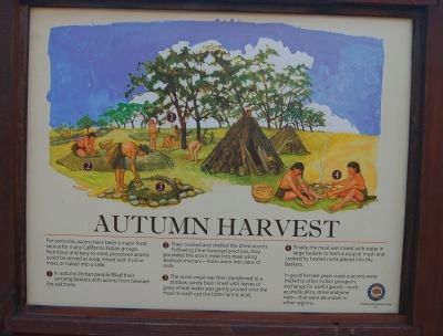
Autumn Harvest
1. In autumn, Indian people filled their carrying baskets with acorns from beneath the oak trees.
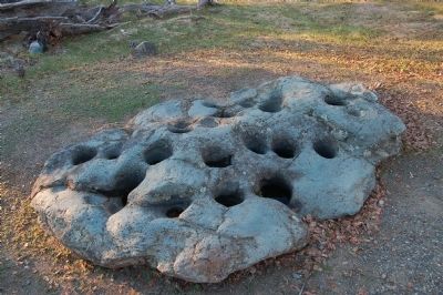
2. They cracked and shelled the dried acorns. Following time-honored practices, they pounded the acorn meat into meal using bedrock mortars – holes worn into slabs of rock.
3. The acorn meal was then transferred to a shallow, sandy basin lined with leaves or grass where water was gently poured over the meal to wash out the bitter tannic acid.
4. Finally, the meal was mixed with water in large baskets to form a soup or mush and cooked by heated rocks placed into the baskets.
In good harvest years surplus acorns were traded to other Indians groups in exchange for useful goods – such as shells, skins, stone and pine nuts – that were abundant in other regions.
Erected 2011 by California State Parks.
Topics. This historical marker is listed in this topic list: Native Americans.
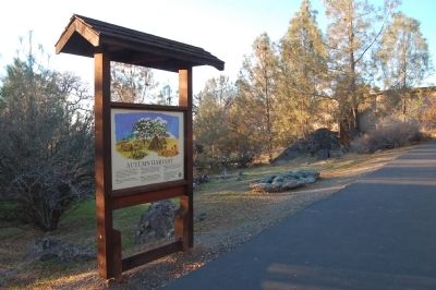
Location. 39° 32.099′ N, 121° 27.963′ W. Marker is near Oroville, California , in Butte County. Marker can be reached from Kelly Ridge Road. This marker is located near the Lake Oroville Visitors Center. Touch for map. Marker is in this post office area: Oroville CA 95966, United States of America. Touch for directions.
Other nearby markers. At least 8 other markers are within 4 miles of this marker, measured as the crow flies. Bidwell Bar Bridge and Tollhouse (approx. 0.6 miles away); The Mother Orange Tree of Butte County (approx. 0.6 miles away); Bidwell's Bar (approx. 0.6 miles away); Oroville Dam (approx. 1.4 miles away); a different marker also named Mother Orange Tree of Butte County (approx. 2.6 miles away); Northern California's Oldest Citrus Tree (approx. 2.6 miles away); Long's Bar (approx. 3.2 miles away); Morris Ravine School (approx. 3.3 miles away). Touch for a list and map of all markers in Oroville.
Credits. This page was last revised on June 16, 2016. It was originally submitted on December 2, 2012, by Barry Swackhamer of Brentwood, California. This page has been viewed 521 times since then and 13 times this year. Photos: 1, 2, 3. submitted on December 2, 2012, by Barry Swackhamer of Brentwood, California. • Syd Whittle was the editor who published this page.


