Fort Oglethorpe in Catoosa County, Georgia — The American South (South Atlantic)
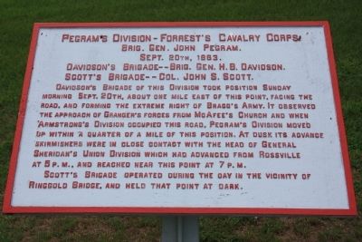
Pegram's Division
Forrest's Cavalry Corps
— Brig. Gen. John Pegram. —
Brig. Gen. John Pegram.
Sept. 20th, 1863.
Davidson's Brigade -- Brig. Gen. H.B. Davidson.
Scott's Brigade -- Col. John S. Scott.
Davidson's Brigade of this Division took position Sunday morning Sept. 20th, about one mile east of this point, facing the road, and forming the extreme right of Bragg's Army. It observed the approach of Granger's forces from McAfee's Church and when Armstrong's Division occupied this road, Pegram's Division moved up within a quarter of a mile of this position. At dusk its advance skirmishers were in close contact with the head of General Sheridan's Union Division which had advanced from Rossville at 5 P.M., and reached near this point at 7 P.M.
Scott's Brigade operated during the day in the vicinity of Ringgold Bridge, and held that point at dark.
Erected 1890 by the Chickamauga and Chattanooga National Military Park Commission. (Marker Number MT-1110.)
Topics. This historical marker is listed in this topic list: War, US Civil. A significant historical month for this entry is September 2005.
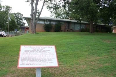
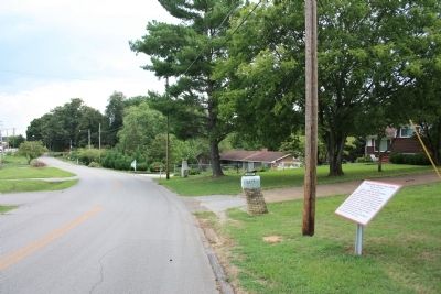
Location. 34° 57.233′ N, 85° 15.622′ W. Marker is in Fort Oglethorpe, Georgia, in Catoosa County. Marker is on Old Lafayette Road north of Gilbert Drive, on the right when traveling south. This historic marker is located in front of a residence on Old Lafayette Road, and this road runs just west, and parallel to, the new Lafayette Road for two blocks, just south of Battlefield Parkway (State Route 2). Touch for map. Marker is at or near this postal address: 1919 Old Lafayette Road, Fort Oglethorpe GA 30742, United States of America. Touch for directions.
Other nearby markers. At least 8 other markers are within walking distance of this marker. 10th Confederate Georgia Cavalry (a few steps from this marker); 6th Georgia Cavalry (about 300 feet away, measured in a direct line); Reserve Corps (about 400 feet away); First Firing on Chickamauga Battlefield (about 400 feet away); Forrest's (Cavalry) Corps. (about 400 feet away); Forrest's Pursuit (about 400 feet away); 1st Georgia Cavalry (about 500 feet away); Armstrong's Brigade. (about 700 feet away). Touch for a list and map of all markers in Fort Oglethorpe.
Credits. This page was last revised on July 2, 2017. It was originally submitted on December 5, 2012, by Dale K. Benington of Toledo, Ohio. This page has been viewed 499 times since then and 11 times this year. Photos: 1, 2, 3. submitted on December 5, 2012, by Dale K. Benington of Toledo, Ohio.


