Near Fort Oglethorpe in Walker County, Georgia — The American South (South Atlantic)
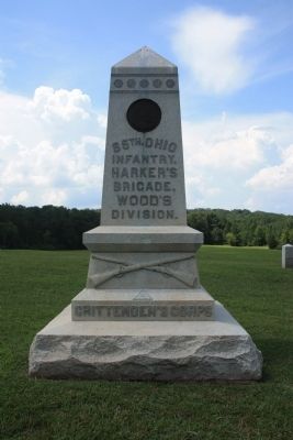
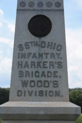
65th Ohio Infantry
Harker's Brigade
— Wood's Division —
Infantry,
Harker's
Brigade,
Woods
Division,
Crittenden's Corps
[Back Side Text]:
At about 3:00 P.M. Sept. 19th, 1863, the 65th Regiment moved with the Brigade from Lee and Gordon's Mills northward on the Lafayette Road engaging the enemy east of the road and attacking the flank and rear of those who had crossed the road north of the Viniard House. At this point the Regiment assisted in the capture of 204 prisoners.
Sept. 20th, after being hotly engaged from 12:00 M. to 1:00 P.M. about 600 yds. south of this ridge, was forced to retire to this position, which it held from 1:30 to about 7:00 P.M. when under orders, it withdrew to Rossville.
Col. Charles G. Harker, of the 65th commanded the Brigade. The Regiment was commanded successively during the action by Lt. Col. Horatio N. Whitbeck, wounded, Maj. Samuel C. Brown, killed, and Capt. Thomas Powell.
Officers and Men engaged 306. Loss, Killed 15: Wounded 71: Captured or Missing 18: Total 104.
Erected 1894 by the State of Ohio. (Marker Number MT-1012.)
Topics. This memorial is listed in this topic list: War, US Civil. A significant historical date for this entry is September 20, 1863.
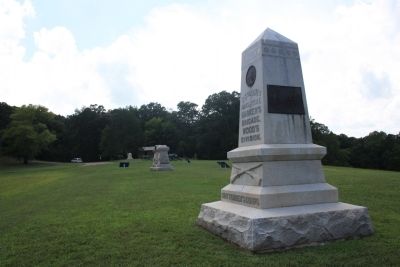
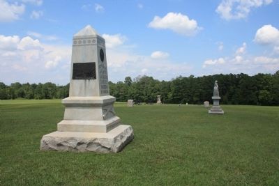
Location. 34° 55.776′ N, 85° 16.034′ W. Marker is near Fort Oglethorpe, Georgia, in Walker County. Memorial can be reached from Vittetoe Road west of Vittetoe-Chickamauga Road when traveling west. This historical marker is located in the northwest section of the Chickamauga National Military Park, along a ridge called Snodgrass Hill. To view this historical marker drive to the parking area in front of the Snodgrass House and the marker can be seen situated in the field just to the northeast of the Snodgrass House. According to the location information provided by the National Park Service the, “Monument is located within the Chickamauga Battlefield on Snodgrass Hill, map site #146”. Touch for map. Marker is in this post office area: Fort Oglethorpe GA 30742, United States of America. Touch for directions.
Other nearby markers. At least 8 other markers are within walking distance of this marker. 41st Ohio Infantry (a few steps from this marker); 64th Ohio Infantry (a few steps from this marker); Hazen's Brigade (a few steps from this marker); 125th Ohio Infantry (a few steps from this marker); Harker's Brigade (within shouting distance of this marker); 9th Indiana Infantry (within shouting distance of this marker); 3rd Kentucky Infantry Regiment (US Volunteers) (within shouting distance of this marker); 37th Indiana Infantry (within shouting distance of this marker). Touch for a list and map of all markers in Fort Oglethorpe.
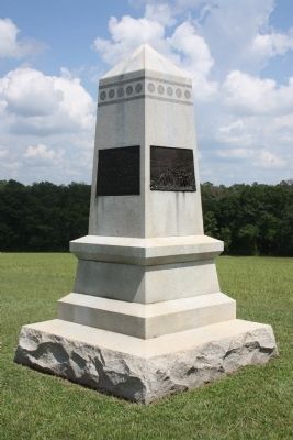
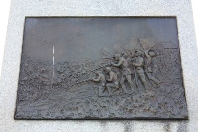
More about this marker. According to the description information provided by the National Park Service, the monument is, “Squat obelisk of smooth-faced granite on rock-faced base, 7' x 7' x 12' high. Front has crossed muskets in relief; raised lettering on shaft; bronze state seal. Sides have bronze tablets with military scenes.”
The National Park Service also identifies C. H. Niehaus and H. W. Beattie, as being the sculptors of this monument and the Vermont Granite Company of Barre, Vermont as being the Architect.
I used the "Chickamauga Battlefield" map, that I purchased at the Chickamauga and Chattanooga National Military Park, Visitor Center, to determine both the monument number for this marker and the marker's location in relation to the rest of the park's monuments, markers, and tablets. According to the map it provides the, "numerical listing of all monuments, markers, and tablets on the Chickamauga Battlefield (using the Chick-Chatt NMP Monument Numbering System).”
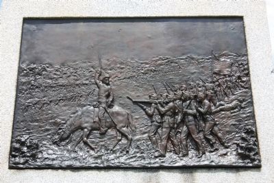
Regarding 65th Ohio Infantry. It should be noted that this monument displays a bronze bas-relief artwork, that depicts the combat action that this regiment saw from this position.
When discussing Battlefield Monuments, the National Park Service offers this special insight: "Of special interest are bronze bas-relief plaques
attached to many monuments. These depict battle scenes based on veterans' eyewitness accounts. Because there are no photographs of the fighting, these plaques are among the best visual records of the battles."
Credits. This page was last revised on October 21, 2020. It was originally submitted on December 9, 2012, by Dale K. Benington of Toledo, Ohio. This page has been viewed 492 times since then and 30 times this year. Photos: 1, 2, 3, 4, 5, 6, 7, 8. submitted on December 9, 2012, by Dale K. Benington of Toledo, Ohio.
