Marthasville in Warren County, Missouri — The American Midwest (Upper Plains)
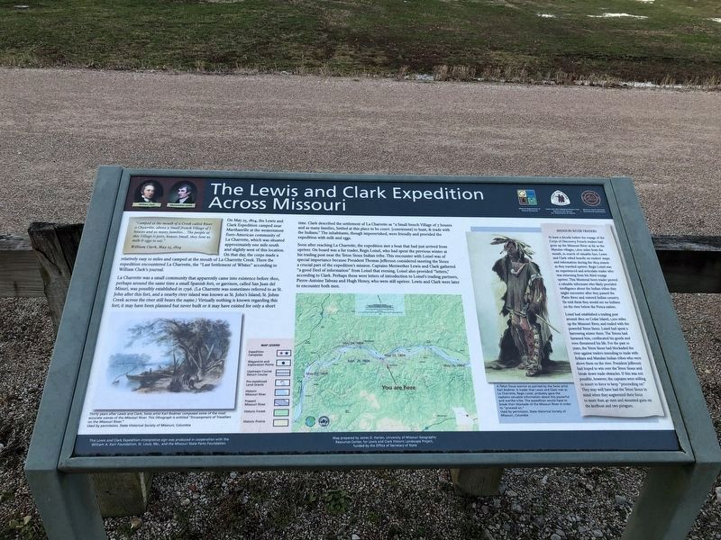
The Lewis and Clark Expedition Across Missouri

Photographed By Devry Becker Jones (CC0), March 19, 2021
1. The Lewis and Clark Expedition Across Missouri Marker
"Camped at the mouth of a Creek called river a Chauritte, above a Small french Village of 7 houses and as many families... The people at this Village is pore, houses Small, they Sent us milk & eggs to eat."
William Clark, May 25, 1804
On May 25, 1804, the Lewis and Clark Expedition camped near Marthasville at the westernmost Euro-American community of La Charrette, which was situated approximately one mile south and slightly west of this location. On that day, the corps made a relatively easy 10 miles and camped at the mouth of La Charrette Creek. There the expedition encountered La Charrette, the "Last Settlement of Whites" according to William Clark's journal.
La Charrette was a small community that apparently came into existence before 1800, perhaps around the same time a small Spanish fort, or garrison, called San Juan del Misuri, was possibly established in 1796. (La Charrette was sometimes referred to as St. John after this fort, and a nearby river island was known as St. John's Island; St. Johns Creek across the river still bears the name.) Virtually nothing is known regarding this fort; it may have been planned but never built or it may have existed for only a short time. Clark described the settlement of La Charrette as "a Small french Village of 7 houses and as many families, Settled at this place to be convt. [convienent] to hunt, & trade with the Indians." The inhabitants, though impoverished, were friendly and provided the expedition with milk and eggs.
Soon after reaching La Charrette, the expedition met a boat that had just arrived from upriver. On board was a fur trader, Regis Loisel, who had spent the previous winter at his trading post near the Teton Sioux Indian tribe. This encounter with Loisel was of specal importance because President Thomas Jefferson considered meeting the Sioux a crucial part of the expedition's mission. Captains Meriwether Lewis and Clark gathered "a good Deel of information" from Loisel that evening. Loisel also provided "letters," according to Clark. Perhaps these were letters of introduction to Loisel's trading partners, Pierre-Antoine Tabeau and Hugh Heney, who were still upriver. Lewis and Clark were later to encounter both men.
Missouri River Traders
At least a decade before the voyage of the Corps of Discovery, French traders had gone up the Missouri River as far as the Mandan villages, 1,600 miles from the mouth, in search of valuable furs. Lewis and Clark relied heavily on traders' maps and information during the 1804 season as they traveled upriver. Regis Loisel was an experienced and articulate trader who was returning from his third voyage upriver. This Montreal-born trader proved a valuable

Photographed By Devry Becker Jones (CC0), March 19, 2021
2. The Lewis and Clark Expedition Across Missouri Marker
Loisel had established a trading post around 1800 on Cedar Island, 1,200 miles up the Missouri River, and traded with the powerful Teton Sioux. Loisel had spent a harrowing winter there. The Tetons had harassed him, confiscated his goods and even threatened his life. For the past 10 years, the Teton Sioux had blockaded the river against traders intending to trade with Arikara and Mandan Indian tribes who were above them on the river. President Jefferson had hoped to win over the Teton Sioux and break down trade obstacles. If this was not possible, however, the captains were willing to resort to force to keep "proceeding on." They may well have had the Teton Sioux in mind when they augmented their force to more than 40 men and mounted guns on the keelboat and two pirogues.
Erected by National Park Service, Missouri Department of Natural Resources, Missouri Lewis and Clark Bicentennial Commission, and the William A. Kerr and Missouri State Parks Foundations.
Topics and series. This historical marker is listed in these topic lists: Exploration • Native Americans • Settlements & Settlers • Waterways & Vessels. In addition, it is included in the Former U.S. Presidents: #03 Thomas Jefferson, and the Lewis & Clark Expedition series lists. A significant historical date for this entry is May 25, 1922.
Location. 38° 37.628′ N, 91° 3.639′ W. Marker is in Marthasville, Missouri, in Warren County. Marker is on 1st Street south of Depot Street, on the left when traveling north. Marker is just east of the Katy Trail State Park kiosk. Touch for map. Marker is in this post office area: Marthasville MO 63357, United States of America. Touch for directions.
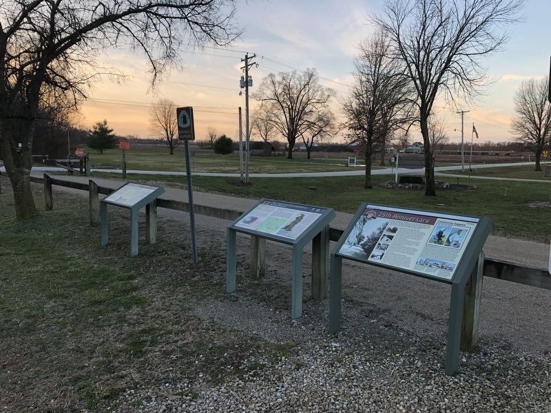
Other nearby markers. At least 8 other markers are within walking distance of this marker. A different marker also named The Lewis and Clark Expedition Across Missouri (here, next to this marker); 25th Anniversary (here, next to this marker); History of Marthasville (a few steps from this marker); Marthasville to Dutzow (a few steps from this marker); Lewis and Clark in Missouri (a few steps from this marker); Marthasville to Treloar (a few steps from this marker); The Daniel Boone Trail (a few steps from this marker); La Charrette / Marthasville (about 300 feet away, measured in a direct line). Touch for a list and map of all markers in Marthasville.
Also see . . .
1. Lewis & Clark National Historic Trail. (Submitted on December 9, 2012, by William Fischer, Jr. of Scranton, Pennsylvania.)
2. The Journals of the Lewis and Clark Expedition. (Submitted on December 9, 2012, by William Fischer, Jr. of Scranton, Pennsylvania.)
3. Lewis & Clark: The Journey of the Corps of Discovery. (Submitted on December 9, 2012, by William Fischer, Jr. of Scranton, Pennsylvania.)
4. Lewis and Clark Across Missouri. (Submitted on December 9, 2012, by William Fischer, Jr. of Scranton, Pennsylvania.)
Credits. This page was last revised on March 24, 2021. It was originally submitted on December 9, 2012, by William Fischer, Jr. of Scranton, Pennsylvania. This page has been viewed 523 times since then and 28 times this year. Photos: 1, 2. submitted on March 24, 2021, by Devry Becker Jones of Washington, District of Columbia.