Vincennes in Knox County, Indiana — The American Midwest (Great Lakes)
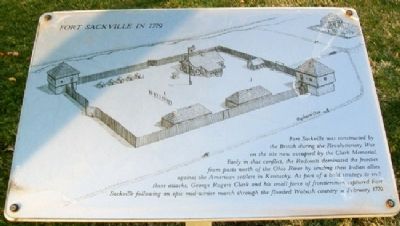
Fort Sackville in 1779
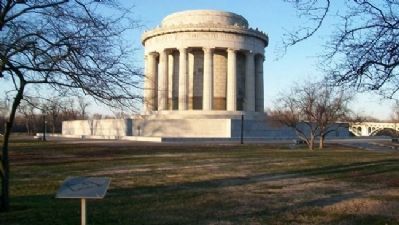
Fort Sackville was constructed by the British during the Revolutionary War on the site now occupied by the Clark Memorial. Early in that conflict, the Redcoats dominated the frontier from posts north of the Ohio River by sending their Indian allies against the American settlers in Kentucky. As part of the bold strategy to end these attacks, George Rogers Clark and his small force of frontiersmen captured Fort Sackville following an epic mid-winter march through the flooded Wabash country in February 1779.
Erected by National Park Service.
Topics. This historical marker is listed in these topic lists: Forts and Castles • Patriots & Patriotism • War, US Revolutionary. A significant historical month for this entry is February 1779.
Location. Marker has been reported permanently removed. It was located near 38° 40.706′ N, 87° 32.141′ W. Marker was in Vincennes, Indiana, in Knox County. Marker is near the George Rogers Clark National Historical Park visitor center at 401 South 2nd Street. Touch for map. Marker was in this post office area: Vincennes IN 47591, United States of America.
We have been informed that this sign or monument is no longer there and will not be replaced. This page is an archival view of what was.
Other nearby markers. At least 8 other markers are within walking distance of this location. Fort Sackville (here, next to this marker); The George Rogers Clark Memorial (about 300 feet away, measured in a direct line); St. Rose Chapel (about 300 feet away); Inscription on the Big Bell of the Old Cathedral (about 300 feet away); Constructing a Legacy (about 300 feet away); Inside the Memorial (about 300 feet away); The Wabash River (about 400 feet away); Site of Fort Sackville (about 400 feet away). Touch for a list and map of all markers in Vincennes.
Also see . . . Fort Sackville. (Submitted on December 13, 2012, by William Fischer, Jr. of Scranton, Pennsylvania.)
Credits. This page was last revised on July 6, 2021. It was originally submitted on December 13, 2012, by William Fischer, Jr. of Scranton, Pennsylvania. This page has been viewed 579 times since then and 17 times this year. Photos: 1, 2. submitted on December 13, 2012, by William Fischer, Jr. of Scranton, Pennsylvania.

