Victor in Ontario County, New York — The American Northeast (Mid-Atlantic)
Athasata (Kryn)
The Great Christian Mohawk Chief
Athasata (Kryn)
The Great Christian Mohawk Chief
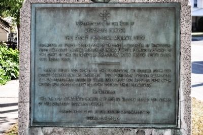
Promoter of Peace - Respecter of Treaties - Defender of Righteousness - Valiant Warrior Leader of Indian Forces, forming one-third of the army of the De Nonville Expedition which passed (1687) along this Indian Trail.
"I cannot speak too highly of the assistance we receive from the Great Mohawk and his warriors" "Our Christian Indians surpassed all and performed deeds of valor especially the Iroquois upon whom we had not dared dared to rely to fight against their relatives."
De Nonville
The name of Athasata merits a place in history beside the names of the greatest Iroquois leaders.
Erected 1939 by Herman G. Hetzler.
Topics. This historical marker is listed in these topic lists: Colonial Era • Exploration • Native Americans.
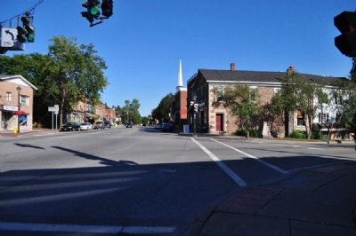
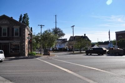
Location. 42° 58.939′ N, 77° 24.567′ W. Marker is in Victor, New York, in Ontario County. Marker is at the intersection of East Main Street (Route 96) and Maple Street (New York State Route 444), on the left when traveling east on East Main Street. Touch for map. Marker is in this post office area: Victor NY 14564, United States of America. Touch for directions.
Other nearby markers. At least 8 other markers are within 2 miles of this marker, measured as the crow flies. Mead Square (about 400 feet away, measured in a direct line); Victor Centennial, 1913 (approx. ¼ mile away); Site of Home and Laboratory of Fred M. Locke (approx. 0.6 miles away); Dyagodiyu (approx. 1.2 miles away); Rochester Area (approx. 1.2 miles away); Graves (approx. 1.2 miles away); Gano'so:d (approx. 1.2 miles away); Gannagaro (approx. 1.2 miles away). Touch for a list and map of all markers in Victor.
Regarding Athasata (Kryn). This marker is over 75 years old, and never could get approved or erected today. Today, the DeNonville Campaign is seen as an aggressive (almost genocidal) European action against Natives. That the marker celebrates a European-allied Native American is interesting, at best.
The Ganondagon State Historic site is several miles south on 444. This was one of DeNonville's targets. A significantly large town of hundreds of Seneca Iroquois was burned to the ground, and many months worth of stored corn was destroyed.
Also see . . . Togouiroui (Athasata) - Dictionary of Canadian Biography Online. (Submitted on December 19, 2012, by Bill Pfingsten of Bel Air, Maryland.)
Additional commentary.
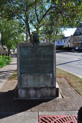
1. Victor Historical Marker
The Kryn marker

Photographed By Yugoboy, September 1, 2012
2. Complete Marker
Interestingly, the head-dress on this marker is not historically accurate. This style of head-dress was more of a Plains Indians style. Iroquois (Haudenoshonee) head-dresses had 3 or fewer feathers (depending on which of the 6 nations the wearer belonged to). This is likely a direct result of the age of the marker.
— Submitted July 15, 2015, by Kathryn of Rochester, New York.
Credits. This page was last revised on June 16, 2016. It was originally submitted on December 16, 2012, by Yugoboy of Rochester, New York. This page has been viewed 998 times since then and 29 times this year. Photos: 1, 2, 3, 4. submitted on December 16, 2012, by Yugoboy of Rochester, New York. • Bill Pfingsten was the editor who published this page.


