Harper Ferry in Allamakee County, Iowa — The American Midwest (Upper Plains)
The Mystery of the Mounds
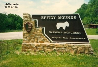
Effigy Mounds National Monument
— National Park Service, U.S. Department of the Interior —
Inscription.
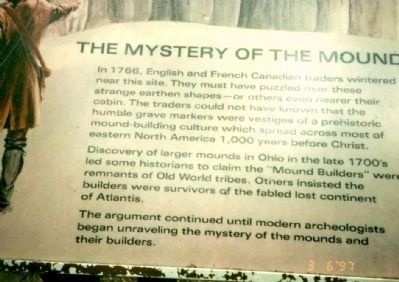
In 1766, English and French Canadian traders wintered near this site. They must have puzzled over these strange earthen shapes-or others even nearer their cabin. The traders could not have known that the humble grave markers were vestiges of a prehistoric mound-building culture which spread across most of eastern North America 1,000 years before Christ.
Discovery of larger mounds in Ohio in the late 1700’s led some historians to claim the “Mound Builders” were remnants of Old World tribes. Others insisted the builders were survivors of the fabled lost continent of Atlantis.
The argument continued until modern archeologists began unraveling the mystery of the mounds and their builders.
Topics. This historical marker is listed in these topic lists: Anthropology & Archaeology • Native Americans. A significant historical year for this entry is 1766.
Location. Marker has been permanently removed. It was located near 43° 5.208′ N, 91° 11.148′ W. Marker was in Harper Ferry, Iowa, in Allamakee County. Marker was on State Highway 76. Touch for map. Marker was at or near this postal address: 151 Highway 76, Harpers Ferry IA 52146, United States of America.
We have been informed that this sign or monument is no longer there and will not be replaced. This page is an archival view of what was.
Other nearby markers. At least 8 other markers are within 4 miles of this location, measured as the crow flies. Old Military Trail (approx. 1½ miles away); L'ancien Cimetiere Francais (approx. 2.1 miles away in Wisconsin); War of 1812 (approx. 2½ miles away in Wisconsin); Villa Louis (approx. 2½ miles away in Wisconsin); Fort Crawford (approx. 2.7 miles away in Wisconsin); Smoke stacks and paddle wheels (approx. 2.7 miles away in Wisconsin); Veterans Memorial (approx. 3 miles away in Wisconsin); Prairie du Chien (approx. 3.1 miles away in Wisconsin).
More about this marker. From the National Park website.
Effigy Mounds National Monument
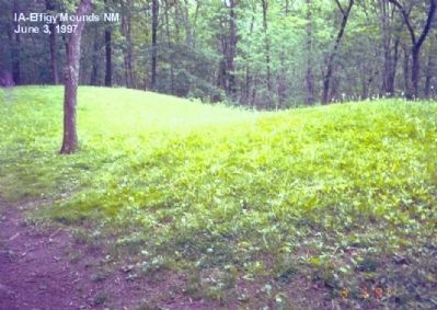
The Late Woodland Period (1400-750 B.P.) along the Upper Mississippi River and extending east to Lake Michigan is associated with the culture known today as the Effigy Moundbuilders. The construction of effigy mounds was a regional cultural phenomenon. Mounds of earth in the shapes of birds, bear, deer, bison, lynx, turtle, panther or water spirit are the most common images. Like earlier groups, the Effigy Moundbuilders continued to build conical mounds for burial purposes, but their burial sites lacked the trade goods of the preceding Middle Woodland Culture. The Effigy Moundbuilders also built linear or long rectangular mounds that were used for ceremonial purposes that remain a mystery. Some archeologists believe they were built to mark celestial events or seasonal observances. Others speculate they were constructed as territorial markers or as boundaries between groups.
The animal-shaped mounds remain the symbol of the Effigy Mounds Culture. Along the Mississippi River in northeast Iowa and across the river in southwest Wisconsin, two major animal mound shapes seem to prevail: the bear and the bird. Near Lakes Michigan and Winnebago, water spirit earthworks—historically called turtle and panther mounds—are more common.
More Information on Archeology at Effigy Mounds
The Range of the Effigy Mound Culture
The Effigy Mound Culture extends from Dubuque, Iowa, north into southeast Minnesota, across southern Wisconsin from the Mississippi to Lake Michigan, and along the Wisconsin-Illinois boundary. The counties of Dubuque, Clayton, and Allamakee contain almost all the effigy mounds found.
What do the Effigy Mounds Represent?
Clues can be found in American Indian legends and mythology and to a lesser extent, scientific research. The stories and legends of the Native Americans whose ancestors built the mounds describe the effigy mounds as ceremonial and sacred sites. Archeologists believe the effigy mounds delineated territories of choice gathering and hunting grounds. Unfortunately, much of the data is inconclusive.
Present day American Indian tribes affiliated with Effigy Mounds National Monument include:
Iowa Tribe of Kansas and Nebraska
Iowa Tribe of Oklahoma
Otoe-Missouria Tribe of Oklahoma
Ho-Chunk Nation of Wisconsin
Winnebago Tribe of Nebraska
Upper Sioux Community of Minnesota
Shakopee Mdewakanton Sioux Community In the State of Minnesota
Lower Sioux Indian Community In the State of Minnesota
Prairie island Indian Community In the State of Minnesota
Sac and Fox Tribe of the Mississippi in Iowa
Sac and Fox Nation of Missouri in Kansas and Nebraska
Sac and Fox Nation of Oklahoma

Photographed By Don Morfe, December 9, 2007
4. The Mystery of the Mounds Marker
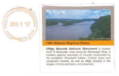
National Park Service Cancellation Stamp-1996 Regional Stamp-Effigy Mounds National Monument is located north of Marquette, Iowa along the Mississippi River. It contains superior examples of mounds constructed by the prehistoric Woodland Indians. Conical, linear and compound mounds, as well as effigy mounds in the shapes of birds and bears, are preserved. Stamp dated June 3, 1997, the date of the visit.
Credits. This page was last revised on September 28, 2023. It was originally submitted on December 19, 2012, by Don Morfe of Baltimore, Maryland. This page has been viewed 1,850 times since then and 39 times this year. Photos: 1, 2, 3, 4. submitted on December 19, 2012, by Don Morfe of Baltimore, Maryland. • Bill Pfingsten was the editor who published this page.
Editor’s want-list for this marker. Clear photo of marker and its surroundings. • Can you help?


