Galesville in Anne Arundel County, Maryland — The American Northeast (Mid-Atlantic)
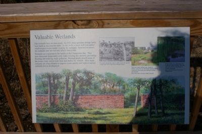
Valuable Wetlands
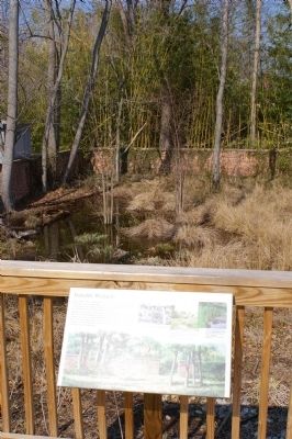
The wetlands here are man-made. In 1926, three gasoline storage tanks were built here on concrete slabs. In the 1940s, a brick wall was added which trapped water inside, creating the wetlands. Seasonal in nature, the wetlands here are only wet after a heavy rain.
Wetlands are important to the health of the Chesapeake Bay. They slow down and temporarily store water running into streams, preventing flooding and reducing water pollution. Wetland plants absorb some of the excess water and provide food and shelter for wildlife. Man-made wetlands are often created to improve water quality and replace natural wetlands lost to development.
[Captions:]
This aerial photograph, taken in 1929, shows the gasoline storage tanks next to the Carrie Weedon House.
This man-made wetland area, created at Adkins Arboretum on Maryland's Eastern Shore, converted a farm pond into habitat for plants and animals.
Homeowners can create their own backyard wetland habitats, like this one at the NOAA Laboratory in Oxford, Maryland.
Topics. This historical marker is listed in this topic list: Environment. A significant historical year for this entry is 1926.
Location. 38° 50.629′ N, 76° 32.5′ W. Marker is in Galesville, Maryland, in Anne Arundel County. Marker can be reached from Main Street. Touch for map. Marker is at or near this postal address: 988 Main Street, Galesville MD 20765, United States of America. Touch for directions.
Other nearby markers. At least 8 other markers are within walking distance of this marker. Native Plants (a few steps from this marker); Steamboat Landing (within shouting distance of this marker); Carrie Weedon House (within shouting distance of this marker); Where Land Meets Water (within shouting distance of this marker); Welcome to Galesville (within shouting distance of this marker); William Penn (about 600 feet away, measured in a direct line); Veterans Memorial (approx. 0.2 miles away); Women of Hartge Yacht Yard (1934-2006) (approx. 0.4 miles away). Touch for a list and map of all markers in Galesville.
Credits. This page was last revised on December 20, 2023. It was originally submitted on March 14, 2008, by Christopher Busta-Peck of Shaker Heights, Ohio. This page has been viewed 1,275 times since then and 36 times this year. Photos: 1, 2, 3. submitted on March 14, 2008, by Christopher Busta-Peck of Shaker Heights, Ohio.


