Near Manassas in Prince William County, Virginia — The American South (Mid-Atlantic)
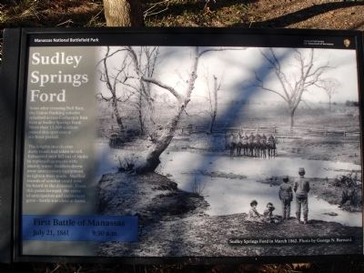
Sudley Springs Ford
First Battle of Manassas
— July 21, 1861 - 9:30 a.m. —
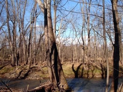
Soon after crossing Bull Run, the Union flanking column splashed across Catharpin Run here at Sudley Springs Ford. More than 13,000 soldiers passed this spot over a six-hour period.
The lengthy march over dusty roads had taken its toll. Exhausted men fell out of ranks to replenish canteens with muddy water. Soldiers threw away unnecessary equipment to lighten loads. Muffled sounds of combat could now be heard in the distance. From this point forward, the sense of anticipation and excitement grew – battle was close at hand.
Erected 2012 by Manassas National Battlefield Park, National Park Service, U.S. Department of the Interior.
Topics. This historical marker is listed in this topic list: War, US Civil.
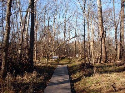
Location. 38° 50.561′ N, 77° 32.268′ W. Marker is near Manassas, Virginia, in Prince William County. Marker can be reached from Sudley Road (Virginia Route 234). Marker is located along the Sudley Loop Trail at Manassas National Battlefield Park. Closest parking is at MNBP Driving Tour Stop No. 5. Touch for map. Marker is at or near this postal address: 5305 Sudley Rd, Manassas VA 20109, United States of America. Touch for directions.
Other nearby markers. At least 8 other markers are within walking distance of this marker. A different marker also named Sudley Springs Ford (a few steps from this marker); Thornberry House (about 300 feet away, measured in a direct line); Field Hospital (about 300 feet away); Sudley Springs (about 500 feet away); A Debt Repaid (approx. 0.2 miles away); Sudley Methodist Church (approx. 0.2 miles away); Sudley Church (approx. ¼ mile away); Sudley (approx. ¼ mile away). Touch for a list and map of all markers in Manassas.
More about this marker. The background of the marker is a photo captioned Sudley Springs Ford in March 1862. Photo by George N. Barnard.
Also see . . . A famous image–and a metaphor for the war. John Hennessy - Remembering: Musings on Fredericksburg and Manassas (and a few other things) (Submitted on December 22, 2012.)
Credits. This page was last revised on April 9, 2022. It was originally submitted on December 22, 2012. This page has been viewed 1,206 times since then and 29 times this year. Photos: 1, 2, 3. submitted on December 22, 2012. • Craig Swain was the editor who published this page.


