Baldwyn in Lee County, Mississippi — The American South (East South Central)
Brice's Cross Roads
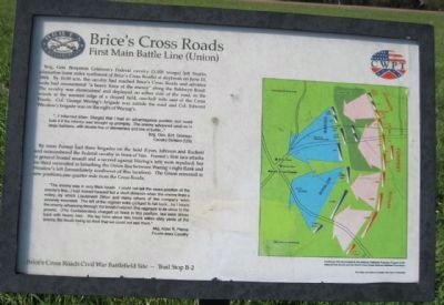
First Main Battle Line (Union)
...I informed (Gen. Sturgis) that I had an advantageous position and could hold it if the infantry was brought up promptly. The enemy advanced upon us in large numbers, with double line of skirmishers and line of battle...
Brig. Gen. B. H. Grierson, Cavalry Division (US)
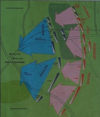
By noon Forrest had three brigades on the field (Lyon, Johnson and Rucker) and outnumbered the Federal cavalry in front of him. Forrest's first two attacks (a general frontal assault and a second against Waring's left) were repulsed, but his third succeeded in breaching the Union line between Waring's right flank and Winslow's left (immediately southwest of this location). The Union retreated to new positions one quarter mile from the Cross Roads.
The enemy was in very thick brush. I could not tell the exact position of the enemy's line....I had moved forward but a short distance when the enemy fired a volley...by which Lieutenant Dillon and many others of the company were severely wounded. The left of the regiment was obliged to fall back...As I heard the enemy advancing through the brush I ordered the regiment to lie close to the ground. (The Confederates) charged us twice in this position, but were driven back with heavy loss. We lay here about two hours within sixty yards of the enemy, the brush being so thick that we could not see them.
Maj. Abial R. Pierce, Fourth Iowa Cavalry
Battle Map Confederate Cavalry converges on Union Cavalry and pushes them towards Brice's Crossroads
Erected by CWPT (Civil War Preservation Trust). (Marker Number B-2.)
Topics. This historical marker is listed in this topic list: War, US Civil. A significant historical month for this entry is June 1950.
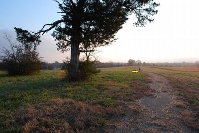
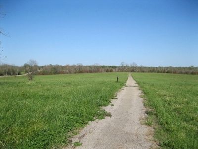
Location. 34° 30.434′ N, 88° 43.383′ W. Marker is in Baldwyn, Mississippi, in Lee County. Marker can be reached from Bethany Road (County Road 370) 0.1 miles east of Guntown/Ripley Road (County Road 370), on the left when traveling west. Interpretive tablet is 1450 feet east of the beginning of a walking trail at Stop 5 of the Brice's Crossroads Auto Tour. The walking trail through Porter's Field parallels Bethany Road and is just under 2000 feet long. Touch for map. Marker is in this post office area: Baldwyn MS 38824, United States of America. Touch for directions.
Other nearby markers. At least 8 other markers are within walking distance of this marker. Tippah, Tishomingo, Pontotoc, Itawamba Intersection (within shouting distance of this marker); Treaty of Pontotoc (within shouting distance of this marker); Battle of Brice's Cross Roads, MS (within shouting distance of this marker); a different marker also named Brice's Cross Roads (about 500 feet away, measured in a direct line); Federal Cavalry and Artillery Formed First Battle Line Here (about 500 feet away); Confederate's Second Battle Line (about 600 feet away); a different marker also named Brice's Cross Roads (approx. ¼ mile away); Federal's Second Battle Line (approx. ¼ mile away). Touch for a list and map of all markers in Baldwyn.
Credits. This page was last revised on June 16, 2016. It was originally submitted on December 27, 2012, by David Graff of Halifax, Nova Scotia. This page has been viewed 830 times since then and 15 times this year. Photos: 1. submitted on December 27, 2012, by David Graff of Halifax, Nova Scotia. 2, 3. submitted on September 25, 2015, by Brandon Fletcher of Chattanooga, Tennessee. 4. submitted on December 27, 2012, by David Graff of Halifax, Nova Scotia. • Craig Swain was the editor who published this page.


