Jackson in Madison County, Tennessee — The American South (East South Central)
Battle of Salem Cemetery
Surprise Attack
— Forrest's Second Tennessee Raid —
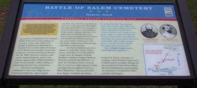
Alarmed by Confederate Gen. Nathan Bedford Forrest's early success in counties to the east, Union Col. Adolph Engelmann stationed his brigade here on both sides of Cotton Grove Road in an attempt to slow his progress. On the morning of December 19, 1862, Forrest's cavalry rode south toward Jackson, and as the column approached, Federal soldiers here fired a deadly volley. killing or wounding several men and horses.
Forrest's cavalrymen retreated to the next ridge north, leaving behind four dismounted troopers who used their dead horses for cover until captured. The Federals regrouped behind the cemetery's iron and wood fence and repelled a brisk cavalry charge, adding to the dead and wounded on the road. Forrest then unlimbered three guns and shelled the Federal position, but most of the rounds went over the heads of the prone Federals and exploded in the treetops.
As the Confederate gunners began to find their range, Engelmann, told that his outnumbered troops were in danger of being flanked, withdrew toward Jackson. Forrest confined the Federals to their fortifications there, freeing him to continue raids against Union rail and communication lines in West Tennessee. During the four-hour battle, Confederate losses totaled 65 killed, wounded, or missing, while Federal losses were 2 killed and 6 wounded. Except for the paving of Cotton Grove Road, the natural features surrounding the cemetery (established 1825) remain unchanged.
Quote: "In wild disorder they turned from the road to the right and left in the open fields, hurrying their shattered and broken ranks without the range of our guns. After a lapse of some fifteen minutes they commenced shelling the wood where we were stationed. The range of their guns was very exact, shells bursting all around us." - Col. Adoph Engelmann, 43 Illinois Infantry
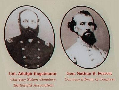
Photos (Top Right): Col. Adolph Engelmann Courtesy Salem Church Battlefield Association, and Gen. Nathan B. Forrest Courtesy Library of Congress
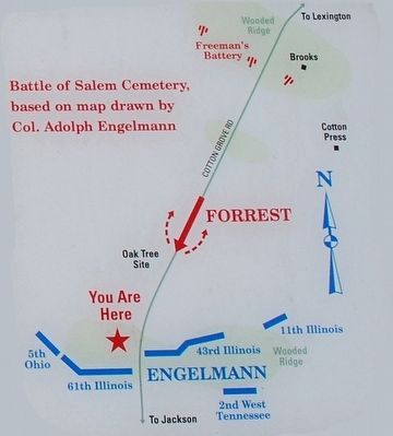
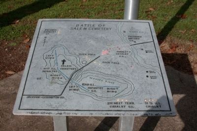
Map (Bottom Right): Battle of Salem Cemetery based on map drawn by Col. Adolph Englemann - includes location of the "Oak Tree" site.
Erected by Civil War Trails (Tennessee).
Topics and series. This historical marker is listed in this topic list: War, US Civil. In addition, it is included in the Tennessee Civil War Trails series list. A significant historical date for this entry is December 19, 2010.
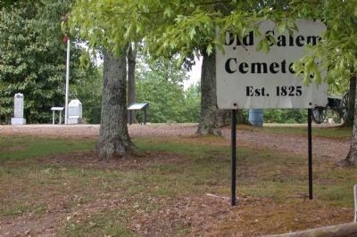
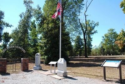
Location. 35° 37.766′ N, 88° 45.966′ W. Marker is in Jackson, Tennessee, in Madison County. Marker can be reached from Cotton Grove Road, 0.3 miles north of N Parkway East/Paul Coffman Drive, on the left when traveling north. Marker is located in the Old Salem Cemetery. Touch for map. Marker is in this post office area: Jackson TN 38305, United States of America. Touch for directions.
Other nearby markers. At least 8 other markers are within 3 miles of this marker, measured as the crow flies. A different marker also named The Battle of Salem Cemetery (within shouting distance of this marker); Unknown Sentry Stands Guard (within shouting distance of this marker); Large Oak Tree (about 400 feet away, measured in a direct line); Jones' Anglewood (approx. 1˝ miles away); John Luther Jones (approx. 2.2 miles away); Lane College (approx. 2.3 miles away); Seven Pillars (approx. 2˝ miles away); Merry High School (approx. 2.6 miles away). Touch for a list and map of all markers in Jackson.
Photographed By David Graff, April 22, 2012
7. Unknown Soldier Statue Location
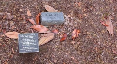
An "Unknown Soldier" statue was placed beside six unknown graves but it was stolen in 2003. The Salem Cemetery Battlefield Association is raising funds to replace it.
This statue is a tribute to the brave troopers of Gen. N.B. Forrest Cavalry, C.S.A. The six headstone represents the 60 to 80 troopers who lost their lives at the Oak Tree Massacre
Sponsored by Salem Cemetery Battlefield Assn. 12-19-2002
This statue is a tribute to the brave troopers of Gen. N.B. Forrest Cavalry, C.S.A. The six headstone represents the 60 to 80 troopers who lost their lives at the Oak Tree Massacre
Sponsored by Salem Cemetery Battlefield Assn. 12-19-2002
Credits. This page was last revised on September 10, 2020. It was originally submitted on December 28, 2012, by David Graff of Halifax, Nova Scotia. This page has been viewed 1,072 times since then and 33 times this year. Photos: 1. submitted on December 28, 2012, by David Graff of Halifax, Nova Scotia. 2, 3. submitted on August 22, 2015, by Brandon Fletcher of Chattanooga, Tennessee. 4. submitted on December 28, 2012, by David Graff of Halifax, Nova Scotia. 5. submitted on August 22, 2015, by Brandon Fletcher of Chattanooga, Tennessee. 6, 7. submitted on December 28, 2012, by David Graff of Halifax, Nova Scotia. • Craig Swain was the editor who published this page.
