Tarboro in Edgecombe County, North Carolina — The American South (South Atlantic)
Occupation of Tarboro
Daniel's Schoolhouse Engagement
— Potters Raid —
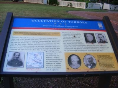
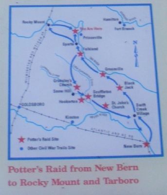
(Preface): On July 18, 1861, Union Gen. Edward E. Potter led infantry and cavalry from New Bern to destroy the Wilmington and Weldon Railroad bridge at Rocky Mount. The Infantry feinted toward Kinston and returned to New Bern. Potter raided Greenville, then sent part of his cavalry to Rocky Mount and occupied Tarboro. The raiders damaged or destroyed bridges, trains and mills before returning to New Bern on July 23, but the Confederates restored rail services by Aug. 1.
Union Gen. Edward E. Potter and a cavalry battalion occupied Tarboro about 9 A.M on July 20, 1963, after driving off Confederate cavalrymen who had come from the direction of Hamilton. Potter ordered Maj. Floyd Clarkson, 12th New York Cavalry, to block the Hamilton road about a mile east of the Tar River bridge. Clarkson, with three cavalry companies and a howitzer, first burned two vessels in the river near the bridge. About four miles from Tarboro, near Daniel’s Schoolhouse, he clashed with Maj. John T. Kennedy and three companies of the 62nt Georgia Cavalry from Fort Branch. After a couple of charges and a few shots from the howitzer, Clarkson retreated to Tarboro in the face of sharp Confederate fire. Federal casualties numbered 6 dead, 14 wounded, and 18 captured.
Maj. George W. Cole led three companies of the 3rd New York Cavalry across the river to assist Clarkson. A mile east of Tarboro, however, Cole encountered Confederate Lt. Col. John C. Lamb, who had marched from Fort Branch with two companies of the 17th North Carolina Infantry and a two-gun section of the Petersburg Artillery. Cole and Lamb exchanged small-arms and cannon fire, and Cole withdrew. The Federals left Tarboro about 5 P.M., partially burned the Tar River bridge, and began the march back to New Bern.
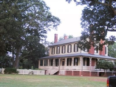
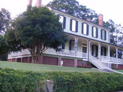
(Sidebar): The Blount-Bridge House, constructed here for Thomas Blount in the Federal style about 1808, was later the home of Lt. Col John L. Bridges (1821-1884). As a captain, Bridges served with distinction in the 1st North Carolina Volunteers during the Battle of Big Bethel on June 10, 1861. He commanded the garrison at Fort Macon on the Outer Banks that fall. His brother, Robert R. Bridges, served in the Confederate Congress until the end of the war.
Erected by North Carolina Civil War Trails.
Topics and series. This historical marker is listed in this topic list: War, US Civil. In addition, it is included in the North Carolina Civil War Trails series list. A significant historical month for this entry is June 1950.
Location. 35° 54.198′ N, 77° 32.238′ W. Marker is in Tarboro, North Carolina, in Edgecombe County. Marker is on
Bridges Street. The marker is in front of the Blount-Bridges House. Touch for map. Marker is at or near this postal address: 130 Bridges Street, Tarboro NC 27886, United States of America. Touch for directions.
Other nearby markers. At least 8 other markers are within walking distance of this marker. U.S.S. Maine Memorial (approx. 0.2 miles away); Town Common (approx. ¼ mile away); Washington's Southern Tour (approx. ¼ mile away); a different marker also named Occupation of Tarboro (approx. ¼ mile away); Edgecombe County Veterans Memorial (approx. 0.3 miles away); God and Country (approx. 0.3 miles away); Edgecombe County Supreme Sacrifice Memorial (approx. 0.3 miles away); General Henry Hugh Shelton (approx. 0.3 miles away). Touch for a list and map of all markers in Tarboro.
Credits. This page was last revised on June 16, 2016. It was originally submitted on December 29, 2012, by Don Morfe of Baltimore, Maryland. This page has been viewed 640 times since then and 19 times this year. Photos: 1, 2, 3, 4, 5. submitted on December 29, 2012, by Don Morfe of Baltimore, Maryland. • Craig Swain was the editor who published this page.
