Church Road in Dinwiddie County, Virginia — The American South (Mid-Atlantic)
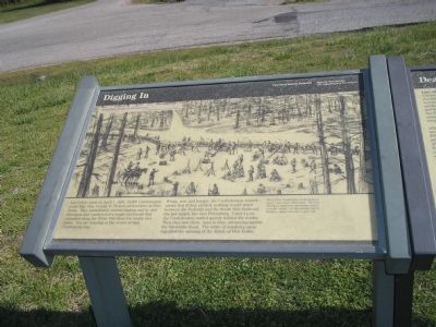
Digging In
Just before noon on April 1, 1865, 10,000 Confederates under Maj. Gen. George E. Pickett arrived here at Five Forks. They immediately started digging and by mid-afternoon had constructed a rough earthwork that extended along the White Oak Road for nearly two miles. You are standing at the center of that Confederate line.
Weary, wet, and hungry, the Confederates waited – aware that if they yielded, nothing would stand between the Federals and the South Side Railroad, the last supply line into Petersburg. Until 4 p.m. the Confederates waited quietly behind the works. Then they saw them: men in blue, advancing astride the Dinwiddie Road. The rattle of musketry soon signaled the opening of the Battle of Five Forks.
Erected by National Park Service, U.S. Department of the Interior.
Topics. This historical marker is listed in this topic list: War, US Civil. A significant historical month for this entry is April 1935.
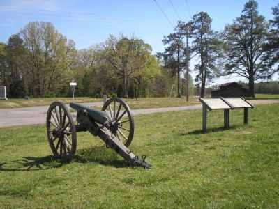
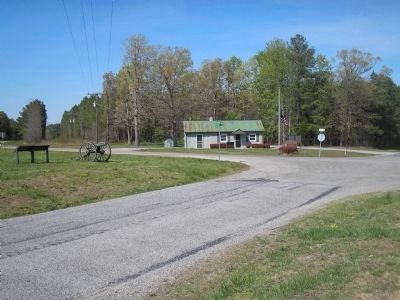
Location. This marker has been replaced by another marker nearby. It was located near 37° 8.357′ N, 77° 37.41′ W. Marker was in Church Road, Virginia, in Dinwiddie County. Marker was at the intersection of White Oak Road (Virginia Route 613), on the right when traveling west on White Oak Road. Marker is in the Five Forks Unit of the Petersburg National Battlefield. It is at the northwest corner of the Five Forks intersection. Touch for map. Marker was at or near this postal address: 645 Wheelers Pond Rd, Church Road VA 23833, United States of America. Touch for directions.
Other nearby markers. At least 8 other markers are within walking distance of this location. Battle of Five Forks (within shouting distance of this marker); Death of Pegram (within shouting distance of this marker); "Hold Five Forks at all hazards…" (within shouting distance of this marker); Five Forks Battlefield (within shouting distance of this marker); a different marker also named The Battle of Five Forks (within shouting distance of this marker); "Advanced…repulsed…charged again…" (approx. 0.3 miles away); Siege of Petersburg — The Linchpin is Pulled (approx. 0.4 miles away); The Siege of Petersburg (approx. 0.4 miles away). Touch for a list and map of all markers in Church Road.
More about this marker. The marker is dominated by a sketch of the Confederates constructing the earthworks at the Five Forks intersection. It includes the caption Most of the Confederate works built on April 1 have been obliterated. The best and most important surviving section is at the “Angle,” on the extreme left of the line – about ¾ mile to your left.
Related marker. Click here for another marker that is related to this marker. This
marker has been replaced with the linked marker.
Also see . . .
1. Battle of Five Forks. Wikipedia entry (Submitted on January 25, 2024, by Larry Gertner of New York, New York.)
2. Battle of Five Forks. National Park Service Petersburg National Battlefield, Virginia website entry (Submitted on March 15, 2008, by Bill Coughlin of Woodland Park, New Jersey.)
Credits. This page was last revised on January 25, 2024. It was originally submitted on March 15, 2008, by Bill Coughlin of Woodland Park, New Jersey. This page has been viewed 1,660 times since then and 47 times this year. Photos: 1, 2, 3. submitted on March 15, 2008, by Bill Coughlin of Woodland Park, New Jersey. • Craig Swain was the editor who published this page.


