Fairlee in Kent County, Maryland — The American Northeast (Mid-Atlantic)
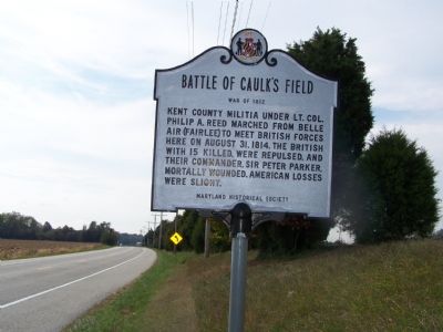
Battle of Caulk’s Field
War of 1812
Erected by Maryland Historical Society.
Topics. This historical marker is listed in these topic lists: Notable Events • War of 1812. A significant historical year for this entry is 1814.
Location. 39° 12.102′ N, 76° 11.227′ W. Marker is in Fairlee, Maryland, in Kent County. Marker is on Maryland Route 20, 0.3 miles north of Maryland Route 21, on the right when traveling south. Touch for map. Marker is in this post office area: Chestertown MD 21620, United States of America. Touch for directions.
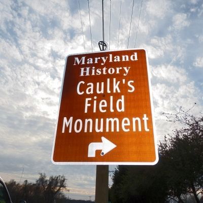
Other nearby markers. At least 8 other markers are within 5 miles of this marker, measured as the crow flies. Caulk’s Field Monument (approx. 0.7 miles away); St. Paul's Oak Tree (approx. 1.1 miles away); Bass Propagation Lake (approx. 2.3 miles away); Rude Awakening (approx. 2.7 miles away); Tolchester Beach Amusement Park (approx. 3 miles away); Martin Wagner (approx. 3.7 miles away); Brampton (approx. 5 miles away); Captain Lambert Wickes (approx. 5.1 miles away). Touch for a list and map of all markers in Fairlee.
Additional commentary.
1. Battle of Caulk’s Field Marker
The wording on the marker appears incorrect. In conversation with local historian Stanley Quick, I realised that what is stated on the monument is a misreading of Lt. Col. Philip Reed's after-battle report, which was written from Belle Air (Fairlee), and gave the impression he and his troops had marched from that location to meet the British. In fact, the militiamen were camped nearer the beach, at Georgetown Crossroads, and made a retrograde march a few hundred yards to meet the British at Caulk's Field.
— Submitted August 24, 2009, by Christopher T. George of Baltimore, Maryland.
Credits. This page was last revised on June 16, 2016. It was originally submitted on October 20, 2007, by Bill Pfingsten of Bel Air, Maryland. This page has been viewed 3,602 times since then and 28 times this year. Last updated on January 10, 2013, by Allen C. Browne of Silver Spring, Maryland. Photos: 1. submitted on October 20, 2007, by Bill Pfingsten of Bel Air, Maryland. 2. submitted on January 10, 2013, by Allen C. Browne of Silver Spring, Maryland.

