Sharpsburg in Washington County, Maryland — The American Northeast (Mid-Atlantic)
Jackson's Command
Taliaferro's Brigade, Jackson's Division
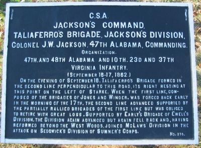
Jackson's Command.
Taliaferro's Brigade, Jackson's Division,
Colonel J.W. Jackson, 47th Alabama, Commanding.
Organization.
47th, and 48th Alabama and 10th, 23d, and 37th
Virginia Infantry.
(September 16-17, 1862.)
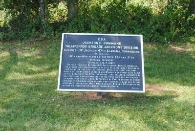
On the evening of September 16, Taliferro's Brigade formed in the second line perpendicular to this road, its right resting at this point on the left of Starke. When the first line, composed of the brigades of Jones and Winder, was forced back early in the morning of the 17th, the second line advanced supported by the partially rallied brigades of the first line but was obliged to retire with great loss. Supported by Early's Brigade of Ewell's Division, the Division again advanced but again fell back and, having reformed beyond the West Woods, joined McLaws' Division in the attack on Sedgwick's Division of Summer's Corps.
Erected by Antietam Battlefield Board. (Marker Number 376.)
Topics and series. This historical marker is listed in this topic list: War, US Civil. In addition, it is included in the Antietam Campaign War Department Markers series list. A significant historical date for this entry is September 16, 1862.
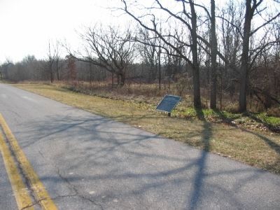
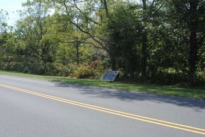
Location. 39° 28.658′ N, 77° 44.843′ W. Marker is in Sharpsburg, Maryland, in Washington County. Marker is on Dunker Church Road / Old Hagerstown Pike, on the right when traveling south. Touch for map. Marker is in this post office area: Sharpsburg MD 21782, United States of America. Touch for directions.
Other nearby markers. At least 10 other markers are within walking distance of this marker. A different marker also named Jackson's Command (within shouting distance of this marker); a different marker also named Jackson's Command (about 400 feet away, measured in a direct line); a different marker also named Jackson's Command (about 400 feet away); Brigadier General William E. Starke (about 500 feet away); "We May Never Meet Again" (about 500 feet away); Philadelphia Brigade Park (about 500 feet away); Longstreet's Command (about 600 feet away); Philadelphia Brigade Monument (about 600 feet away); "With Flags Flying" (about 600 feet away); The Onward Rush to Victory or Defeat (about 600 feet away). Touch for a list and map of all markers in Sharpsburg.
More about this marker. The marker has misspelled the name of Federal General Edwin Sumner, commanding the Union's II Corps.
Also see . . .
1. Antietam Battlefield. National Park Service site. (Submitted on March 16, 2008, by Craig Swain of Leesburg, Virginia.)
2. Taliaferro's Brigade. With General William B. Taliaferro wounded at the Second Battle of Manassas, Col. E.T.H. Warren commanded the Brigade at the start of the Antietam Campaign. Warren was wounded early in the fighting around the West Woods on September 17, and succeeded by Col. James W. Jackson. Col. Jackson himself was wounded later in the morning, turning command over to Lt. Col. John F. Terry, of the 37th Virginia. Terry was wounded almost immediately after taking command, and the responsibility fell to Col. James Sheffield of the 48th Alabama. In short, a very interesting evolution of command under fire. (Submitted on March 16, 2008, by Craig Swain of Leesburg, Virginia.)
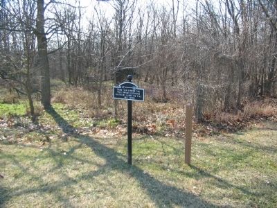
Photographed By Craig Swain, February 9, 2008
6. Corner of the West Woods
Just to the north of the tablet is this sign indicating "From this corner the West Woods extended southeast along the Pike 465 yards." When the Brigade re-oriented to face the advance of Doubleday's Federal Division during the opening phase of the battle, the center of the brigade was here. The facing had changed from north to east, and aligned with the Pike.
Credits. This page was last revised on October 23, 2017. It was originally submitted on March 16, 2008, by Craig Swain of Leesburg, Virginia. This page has been viewed 1,020 times since then and 37 times this year. Photos: 1. submitted on March 16, 2008, by Craig Swain of Leesburg, Virginia. 2. submitted on October 16, 2015, by Brian Scott of Anderson, South Carolina. 3. submitted on March 16, 2008, by Craig Swain of Leesburg, Virginia. 4, 5. submitted on October 16, 2015, by Brian Scott of Anderson, South Carolina. 6. submitted on March 16, 2008, by Craig Swain of Leesburg, Virginia.
