Near South Hutchinson in Reno County, Kansas — The American Midwest (Upper Plains)
Ben Blanchard and Reno County Salt
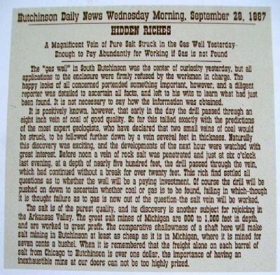
Wednesday Morning,
September 28, 1887
Hidden Riches
A Magnificent Vein of Pure Salt Struck
in the Gas Well Yesterday-
Enought to Pay Abundantly for Working
if Gas is not Found
———————
The "gas well" in South Hutchinson was the center of curiosity yesterday, but all applications to the enclosure were firmly refused by the workmen in charge. The happy looks of all concerned portended something important, however, and a diligent reporter was detailed to ascertain all facts, and left to his wits to learn what had just been found. It is not necessary to say how the information was obtained.
It is positively known, however, that early in the day the drill passed through an eight inch vein of coal of good quality. So far this tallied exactly with the predictions of the most expert geologists, who have declared that two small veins of coal would be struck, to be followed further down by a vein several feet in thickness. Naturally this discovery was exciting, and the developments of the next hour were watched with great interest. Before noon a vein of rock salt was penetrated and just at six o'clock last evening, at a depth of nearly 500 feet, the drill passed through the vein, which had continued without a break for over twenty feet. This rich find settled all questions as to whether the well will be a paying investment. Of course the drill will be pushed on down to ascertain whether coal or gas is to be found, failing in which-though it is thought failure as to gas is now out of the question - the salt vein will be worked.
The salt is of the purest quality, and its discovery is another subject for rejoicing in the Arkansas Valley. The great salt mines of Michigan are 800 to 1,000 feet in depth, and are worked to great profit. The comparative shallowness of a shaft here will make salt mining in Hutchinson at least as cheap as it is in Michigan, where it is mined for seven cents a bushel. When it is remembered that the freight alone on each barrel of salt from Chicago to Hutchinson is over one dollar, the importance of having an inexhaustible mine at our doors can not be too highly prized.
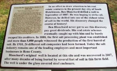
In an effort to draw attention to his real estate ventures in the present day city of South Hutchinson, Ben Blanchard drilled a well in September of 1887. He was hoping to strike oil. However, he drilled into one of the richest veins of salt in the world. His discovery changed the course of history!
Ben Blanchard never got to see this discovery pay dividents. His real estate
schemes eventually caught up with him and he barely escaped his creditors. In 1888, the first salt processing plant was established and more than 5,000 people witnessed the production of the first barrel of salt. By 1910, 26 different salt companies had been formed. Today the salt industry remains one of the leading employers and most important businesses in Reno County.
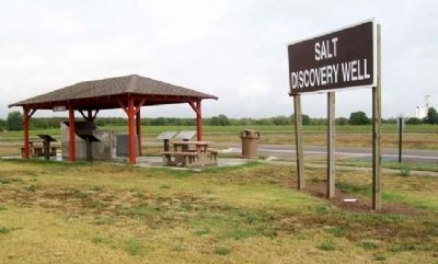
Blanchard's original well is located at this site and was uncovered in 2007, after many decades of being buried by several feet of soil in this farm field. The well is under the glass covered steel enclosure.
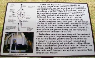
In 1898, Mr. Joy Morton purchased land in the northwest part of South Hutchinson and commenced construction of a new salt plant. Like many of the other salt operations beginning in the Reno County area, the technology to process salt at that time was the use of large open pans called grainer pans. The water in the salt brine was boiled off, leavning a bed of salt in the bottom of these large pans where it was collected.
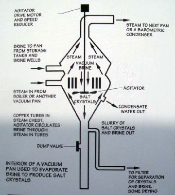
In 1907, a modern and more effective set of salt crystalizers replaced the grainer pans. This new system of using large closed vessels called vacuum pans changed salt production as we know it. These three pans, each over fifty feet tall, are much more efficient than the old open grainer pan process as they use less energy and produce more uniform salt crystals.
Today those same three pans, along with four additional vessels, are a part of the production process at the Morton Salt Facility located just two miles north of this site. Through a transportation system of railroads and highways, high quality salt products are shipped from South Hutchinson to points as far west as California and Hawaii, north to consumers and manufacturers in Wisconsin and Minnesota, and southwest into the northern territories of Mexico.
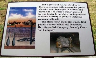
Salt is processed in a variety of ways. The most common is the evaporation process whereby water is pumped into a shaft and drawn out. The water is then evaporated leaving behind brine which can be processed to create a variety of products including common table salt.
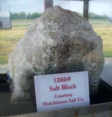
The block of salt on display weighs 1260 pounds and was mined and donated by Hutchinson Salt Company, formerly Carey Salt Company.
Topics. This historical marker is listed in these topic lists: Environment • Exploration • Industry & Commerce • Settlements & Settlers. A significant historical date for this entry is September 28, 1887.
Location. 38° 0.823′ N, 97° 56.753′ W. Marker is near South Hutchinson, Kansas, in Reno
County. Marker is on Des Moines Avenue, ¼ mile west of Main Street, on the left when traveling west. Markers are at a roadside park just north of US Hwy 50. Touch for map. Marker is in this post office area: Hutchinson KS 67501, United States of America. Touch for directions.
Other nearby markers. At least 8 other markers are within 3 miles of this marker, measured as the crow flies. Reno County Salt Discovery Site (here, next to this marker); Hess Feed Store (approx. 2.6 miles away); American Hotel (approx. 2.6 miles away); Magers Agricultural Implements (approx. 2.6 miles away); O'Brian's Grocery (approx. 2.6 miles away); Hutchinson Implement Co. (approx. 2.6 miles away); Hutchinson Auto and Tractor School (approx. 2.6 miles away); Warren G. Harding (approx. 2.7 miles away).
Also see . . .
1. Salt in Kansas. (Submitted on January 20, 2013, by William Fischer, Jr. of Scranton, Pennsylvania.)
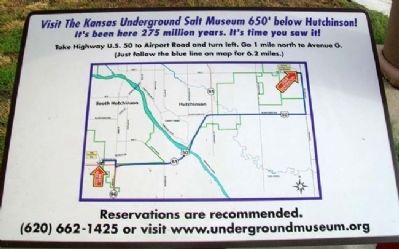
2. Kansas Underground Salt Museum. (Submitted on January 20, 2013, by William Fischer, Jr. of Scranton, Pennsylvania.)
Credits. This page was last revised on June 16, 2016. It was originally submitted on January 20, 2013, by William Fischer, Jr. of Scranton, Pennsylvania. This page has been viewed 588 times since then and 34 times this year. Photos: 1, 2, 3, 4, 5, 6, 7, 8. submitted on January 20, 2013, by William Fischer, Jr. of Scranton, Pennsylvania.
