Pompton Plains in Pequannock Township in Morris County, New Jersey — The American Northeast (Mid-Atlantic)
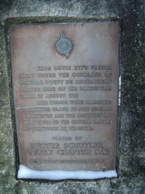
Mandeville Farm Encampment Site
Yorktown Bicentennial 1981
King Louis XVI’s French Army under the command of General Count de Rochambeau camped here on the Mandeville Farm in August 1781.
The troops were marching from Rhode Island to join General Washington and the Continental Army prior to the crucial Battle of Yorktown in Virginia.
Erected 1981 by Daughters of the American Revolution, Hester Schuyler Colfax Chapter.
Topics and series. This historical marker is listed in this topic list: War, US Revolutionary. In addition, it is included in the Daughters of the American Revolution, the Former U.S. Presidents: #01 George Washington, and the The Washington-Rochambeau Route series lists. A significant historical year for this entry is 1781.
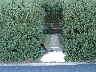
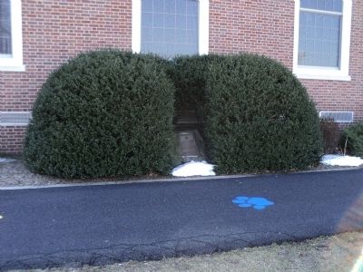
Location. 40° 57.641′ N, 74° 17.719′ W. Marker is in Pequannock Township, New Jersey, in Morris County. It is in Pompton Plains. Marker is at the intersection of Newark Pompton Turnpike and Dogwood Lane, on the left when traveling north on Newark Pompton Turnpike. Marker is located in front of the Pequannock Valley School. Touch for map. Marker is at or near this postal address: 493 Newark Pompton Turnpike, Pompton Plains NJ 07444, United States of America. Touch for directions.
Other nearby markers. At least 8 other markers are within 2 miles of this marker, measured as the crow flies. Giles Mandeville House (approx. 0.2 miles away); First Reformed Church (approx. ¼ mile away); Newark – Pompton Turnpike (approx. ¼ mile away); Pompton Plains 9/11 Memorial (approx. ¼ mile away); Pompton Plains “Brick Schoolhouse” (approx. 0.3 miles away); Martin Berry House (approx. 0.8 miles away); Jesse Van Ness Farm (approx. 1.1 miles away); Morris Canal (approx. 1.2 miles away).
Credits. This page was last revised on December 14, 2023. It was originally submitted on January 27, 2013, by Bill Coughlin of Woodland Park, New Jersey. This page has been viewed 870 times since then and 42 times this year. Last updated on January 31, 2021, by Carl Gordon Moore Jr. of North East, Maryland. Photos: 1, 2, 3, 4, 5. submitted on January 27, 2013, by Bill Coughlin of Woodland Park, New Jersey. • Bill Pfingsten was the editor who published this page.


