Near Fort Oglethorpe in Catoosa County, Georgia — The American South (South Atlantic)
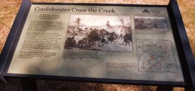
Confederates Cross the Creek
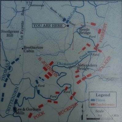
On the afternoon of September 18, 1863 - the day before the main battle - Confederate forces pushed across Chickamauga Creek. They crossed at Reeds Bridge (3/4 mile east of here to your right), and at several shallow fords. Union units offered some resistance, but were outnumbered.
The Confederates who crossed at Reeds Bridge turned south down the road behind you to attack the Union left at Lee and Gordons Mills. As twilight approached, the last Confederates crossed the creek and marched past this point. Union Col. Dan McCook spotted the enemy soldiers and captured some stragglers. He then burned Reeds Bridge and reported that an "isolated" Confederate brigade was trapped on this side of the creek.
McCook's men settled down for the night near this spot. At dawn they hoped to be reinforced and destroy the "trapped" Confederate unit.
Erected by Chickamauga and Chattanooga National Military Park.
Topics. This historical marker is listed in this topic list: War, US Civil. A significant historical date for this entry is September 18, 1887.
Location. 34° 55.831′ N, 85° 13.738′ W. Marker is near Fort Oglethorpe, Georgia, in Catoosa County. Marker is at the intersection of Jays Mill Road and Reeds Bridge Road, on the right when traveling south on Jays Mill Road. Marker is in front of several parking spaces at a clearing beside a forest. This was the wartime site of Jay's Mill. Touch for map. Marker is in this post office area: Fort Oglethorpe GA 30742, United States of America. Touch for directions.
Other nearby markers. At least 8 other markers are within walking distance of this marker. 4th United States Cavalry (a few steps from this marker); Johnson's Provisional Division (a few steps from this marker); Dibrell's Brigade (a few steps from this marker); Minty's Cavalry Brigade (within shouting distance of this marker); 4th Michigan Cavalry (within shouting distance of this marker); 7th Pennsylvania Cavalry (within shouting distance of this marker); Pegram's Division (about 400 feet away, measured in a direct line); Huwald's Tennessee Battery (about 600 feet away). Touch for a list and map of all markers in Fort Oglethorpe.
Regarding Confederates Cross the Creek.
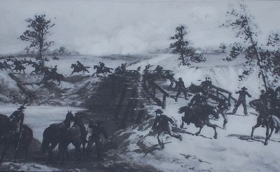
Center Drawing shows action at Reeds Bridge and is captioned: The Union cavalry of Col. Robert Minty held Reeds Bridge until about 1:30 p.m. on September 18 when Confederate Maj. Gen. Nathan Bedford Forrest's dismounted cavalry and Brig. Gen. Bushrod R. Johnson's infantry drove them back. Confederate forces began crossing in numbers about 4:30 p.m. The bridge was located less than a mile from here via the road crossing to your right.
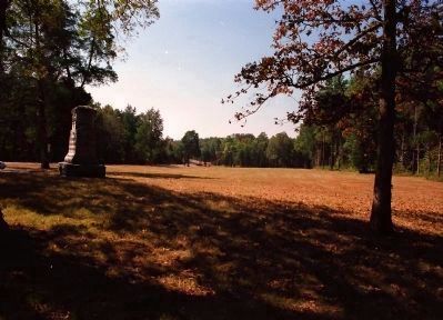
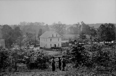
Photograph Upper Right is captioned: After crossing the creek the Confederates planned to attack the Union left which they believed was near Lee and Gordons Mill, four miles south of here.
Map Bottom Right is captioned: On September 18, Confederate forces crossed to the west side of Chickamauga Creek, where, on the following two days, they would fight one of the bloodiest battles of the war.
Credits. This page was last revised on June 16, 2016. It was originally submitted on January 29, 2013, by David Graff of Halifax, Nova Scotia. This page has been viewed 804 times since then and 26 times this year. Photos: 1. submitted on January 29, 2013, by David Graff of Halifax, Nova Scotia. 2, 3. submitted on August 19, 2015, by Brandon Fletcher of Chattanooga, Tennessee. 4. submitted on January 29, 2013, by David Graff of Halifax, Nova Scotia. 5. submitted on August 19, 2015, by Brandon Fletcher of Chattanooga, Tennessee. • Craig Swain was the editor who published this page.
