Hermann in Gasconade County, Missouri — The American Midwest (Upper Plains)
Pioneer Trails Juncture
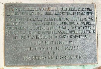
This is an American Revolution Bicentennial Memorial marking the juncture of three famous pioneer trails here.
They are the Lewis and Clark Trail 1804-1806, the Ozark Frontier Trail mid-1800's and the Old Iron Road which linked the Meramec Iron Foundry at St. James, Mo. with the port city of Hermann on the mighty Missouri i, over which the ore was hauled by ox carts 1840-1860.
Erected 1976 by The City of Hermann and the Hermann Lions Club.
Topics. This historical marker is listed in these topic lists: Industry & Commerce • Roads & Vehicles • Settlements & Settlers • Waterways & Vessels.
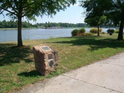
Location. 38° 42.471′ N, 91° 25.933′ W. Marker is in Hermann, Missouri, in Gasconade County. Marker is in Riverfront Park, accessed off Wharf Street. Touch for map. Marker is in this post office area: Hermann MO 65041, United States of America. Touch for directions.
Other nearby markers. At least 8 other markers are within walking distance of this marker. The Lewis and Clark Expedition Across Missouri (a few steps from this marker); Voyage of Discovery (within shouting distance of this marker); 232 Wharf St. (about 300 feet away, measured in a direct line); The Caboose Museum (about 400 feet away); Monnig Family General Store (about 400 feet away); Hermann (about 600 feet away); The Concert Hall and Barrel Bar (approx. 0.2 miles away); The Wohlt House (approx. 0.2 miles away). Touch for a list and map of all markers in Hermann.
Also see . . . Lewis and Clark National Historic Trail. (Submitted on February 10, 2013, by William Fischer, Jr. of Scranton, Pennsylvania.)
Credits. This page was last revised on March 25, 2021. It was originally submitted on February 10, 2013, by William Fischer, Jr. of Scranton, Pennsylvania. This page has been viewed 443 times since then and 9 times this year. Photos: 1, 2. submitted on February 10, 2013, by William Fischer, Jr. of Scranton, Pennsylvania.

