Near Sutter in Sutter County, California — The American West (Pacific Coastal)
Major General John C. Fremont and his Expedition
Inscription.
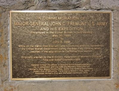
In Commemoration of Major General John C. Fremont, U.S. Army, and his expedition, encamped in the Sutter Buttes in this vicinity, May 30, 1848, to June 8, 1848.
While on the march from Klamath Lake to Sonoma when he represented the United States Government during the Bear Flag Uprising which resulted in the acquisition of California from Mexico.
Originally erected by the Bi-County Federation of Women's Clubs of Yuba and Sutter Counties, 1923.
Restored through the efforts of the Save the Sutter Buttes Association in conjunction with the Yuba City Women's Club, Live Oak Women's Club, Bogue Country Club, Quota Club Kiwanis Early Risers, Rotary Club of Marysville, Tierra Buena Women's Club, Sutter Federated Women's Club and interested individuals, 1979.
Erected 1979 by various local civic organizations (see marker text for detail).
Topics. This historical marker is listed in these topic lists: Exploration • War, Mexican-American. A significant historical date for this entry is May 30, 1855.
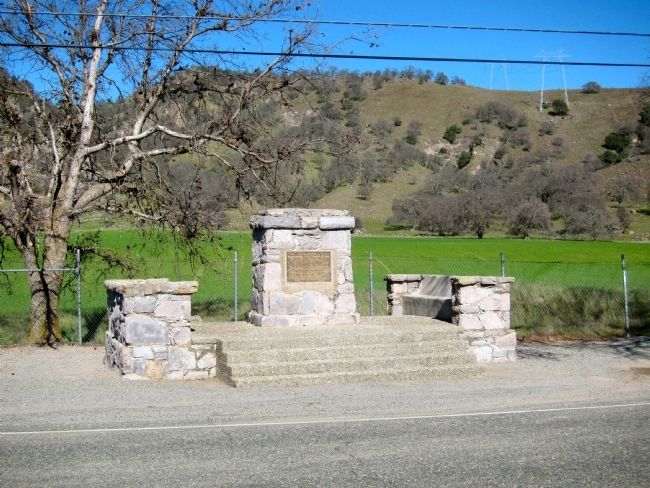
Location. 39° 11.184′ N, 121° 46.401′ W. Marker is near Sutter, California, in Sutter County. Marker is on Pass Road, 1˝ miles west of Butte House Road, on the right when traveling west. Touch for map. Marker is in this post office area: Sutter CA 95982, United States of America. Touch for directions.
Other nearby markers. At least 8 other markers are within 10 miles of this marker, measured as the crow flies. Site of Propagation of the Thompson Seedless Grape (approx. 2.9 miles away); Sutter County Veterans Memorial (approx. 7.8 miles away); Sam Brannan Park (approx. 8.4 miles away); Mosburg Building (approx. 9 miles away); Teegarden House (approx. 9 miles away); Veterans Memorial Monument (approx. 9˝ miles away); Masonic Temple Corner Stone (approx. 9.6 miles away); Historical Marysville City Cemetery (approx. 10 miles away).
More about this marker. The marker is in error with regard to the dates mentioned - the events described occurred in 1846, not 1848. Note also, that this plaque is a replacement of a nearly identical plaque, differing only slightly in layout from its predecessor. It is uncertain in which year this version of the marker was installed.
Also see . . .
1. Captain John Charles Fremont and the Bear Flag Revolt. The California State Military Museum's page describing Fremont's role in the Bear Flag Revolt. (Submitted on February 12, 2013.)
2. Work of the Women's Clubs. USgenweb's excerpts of the 1924 History of Yuba and Sutter Counties California With Biographical Sketches OF The Leading Men.... On the unveiling of the monument to Fremont, "... Sunday, April 15. 1923, witnessed the first important dedication of a landmark on the Sutter side of the river.
On that date, beginning at two o'clock in the afternoon, in the presence of a large assemblage, the Bi-County Federation, of which Mrs. C. H. Dam of Wheatland was then president, unveiled amonument erected upon the spot in the South Butte Pass where Capt. John C. Fremont, the, "Pathfinder," camped in 1846...." (Submitted on February 12, 2013.)
Credits. This page was last revised on June 16, 2016. It was originally submitted on February 12, 2013, by Andrew Ruppenstein of Lamorinda, California. This page has been viewed 1,096 times since then and 66 times this year. Photos: 1, 2. submitted on February 12, 2013, by Andrew Ruppenstein of Lamorinda, California. • Syd Whittle was the editor who published this page.
Editor’s want-list for this marker. Historical photo of the original monument. • Can you help?

