Near Mill Creek in Shasta County, California — The American West (Pacific Coastal)
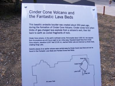
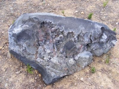
Cinder Cone Volcano and the Fantastic Lava Beds
Cinder Cone volcano, in the park’s northeast corner, first erupted about 1650 AD. Ash deposits from its eruption are still found eight to ten miles away. Repeated basalt flows from Cinder Cone volcano, elevation 6,907 feet (2105 m) reached Butte Lake and dammed up Butte Creek, creating Snag Lake.
Colorful pieces of an earlier volcano were carried away by Cinder Cone’s lava flow and can be found in the Fantastic Lava Beds and Painted Dunes lava fields.
Erected by National Park Service.
Topics. This historical marker is listed in this topic list: Environment. A significant historical year for this entry is 1650.
Location. 40° 26.91′ N, 121° 32.136′ W. Marker is near Mill Creek, California, in Shasta County. Marker can be reached from Lassen Peak Highway (State Highway 89), on the right when traveling south. Marker is located within the boundaries of Lassen Volcanic National Park at a trail parking area near Mill Creek. Touch for map. Marker is in this post office area: Mill Creek CA 96061, United States of America. Touch for directions.
Other nearby markers. At least 8 other markers are within 7 miles of this marker, measured as the crow flies. Bumpass’s Hell (approx. 1.6 miles away); Pluck and Carry (approx. 1.9 miles away); A Scenic Boulevard (approx. 2.7 miles away); A Night to Remember / Three Days Later (approx. 5.9 miles away); Hot Rock (approx. 6 miles away); Loomis Legacy (approx. 6.2 miles away); Stephen Tyng Mather (approx. 6.3 miles away); Nobles Trail - Manzanita Creek (approx. 6.9 miles away).
Credits. This page was last revised on June 16, 2016. It was originally submitted on February 15, 2013, by Don Morfe of Baltimore, Maryland. This page has been viewed 579 times since then and 14 times this year. Photos: 1, 2. submitted on February 15, 2013, by Don Morfe of Baltimore, Maryland. • Syd Whittle was the editor who published this page.
Editor’s want-list for this marker. Full view of the marker. • Wide area view of the marker and its surroundings. • Photo of Cinder Cone Volcano and Lava Beds. • • Can you help?

