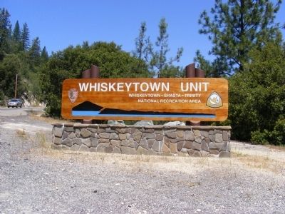
Whiskeytown in Shasta County, California — The American West (Pacific Coastal)
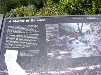
A Matter of Balance
Wiskeytown National Recreation Area
By the 1990s, California’s Central Valley had lost more than 90% of its river and streamside forests and wetlands. Salmon spawning grounds had shrunk from 6,000 stream miles to less than 300. Past agricultural and industrial activities and development by the CVP shared in the responsibility for this decline. In response to public will and new laws, the CVP is working to restore critical spawning habitat.
The U.S. Bureau of Reclamation manages the Central Valley Project. The 1992 Central Valley Project Improvement Act amended the CVP’s mission to provide for fish and wildlife protection.
Erected by National Park Service.
Topics. This historical marker is listed in this topic list: Environment. A significant historical year for this entry is 1992.
Location. 40° 36.012′ N, 122° 32.142′ W. Marker is in Whiskeytown, California, in Shasta County. Marker can be reached from Kennedy Memorial Drive. Marker is located at the Wiskeytown Lake Visitor Center. Touch for map . Marker is in this post office area: Whiskeytown CA 96095, United States of America. Touch for directions.
Other nearby markers. At least 8 other markers are within 3 miles of this marker, measured as the crow flies. The Glory Hole (here, next to this marker); A Matter of Progress (here, next to this marker); Kennedy Memorial (within shouting distance of this marker); Central Valley Project (within shouting distance of this marker); Pioneer Baby's Grave (approx. 1.9 miles away); Shasta (approx. 2.3 miles away); Shasta County Court House (approx. 2.3 miles away); Survivors of the Gold Rush (approx. 2.3 miles away). Touch for a list and map of all markers in Whiskeytown.
Credits. This page was last revised on June 16, 2016. It was originally submitted on February 16, 2013, by Don Morfe of Baltimore, Maryland. This page has been viewed 467 times since then and 13 times this year. Photos: 1, 2, 3, 4, 5. submitted on February 16, 2013, by Don Morfe of Baltimore, Maryland. • Syd Whittle was the editor who published this page.
Editor’s want-list for this marker. A full view of the marker • Can you help?
