Whiskeytown in Shasta County, California — The American West (Pacific Coastal)
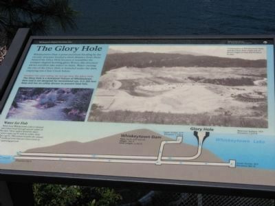
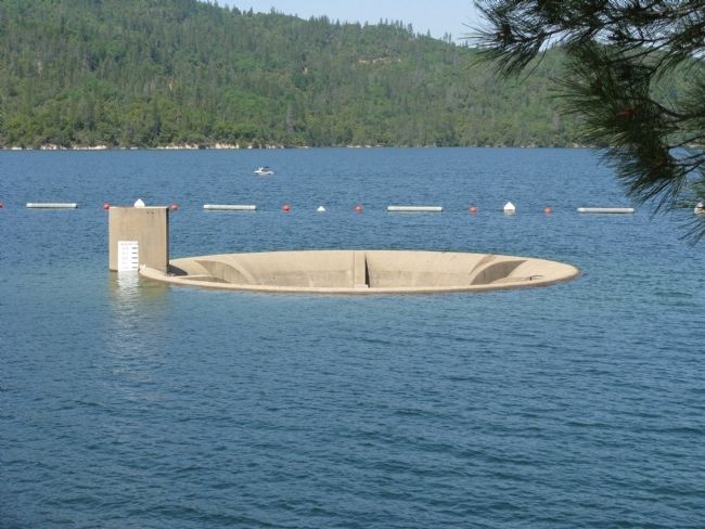
The Glory Hole
Whiskeytown National Recreation Area

May 8, 2008
1. The Glory Hole Marker
Photo captions:
Construction of Whiskeytown Dam and the Glory Hole (right side of photo) began in 1959 and finished in 1963.
Water for Fish — Water from Whiskeytown Lake is released into Clear Creek through special outlets in the dam. These outlets blend the lake’s warmer water (57 F) with its colder, deep water (45 F). This system benefits the salmon and steelhead trout that use Clear Creek as their spawning ground.
Caution - for your safety, do not go near the Glory Hole.
The Glory Hole is a functional feature of Whiskeytown Dam and is not designed for recreational use. It is 260 feet deep and has no safety devices to prevent fatal falls.
Whiskeytown Dam—Type: Earth and rock fill; Height: 282 ft; Crest Length: 2,250 ft.
Erected by National Park Service.
Topics. This historical marker is listed in this topic list: Environment.
Location. 40° 36.012′ N, 122° 32.142′ W. Marker is in Whiskeytown, California, in Shasta County. Marker is on Kennedy Memorial Drive. Marker is located at the Wiskeytown Lake Visitor Center. Touch for map. Marker is in this post office area: Whiskeytown CA 96095, United States of America. Touch for directions.
Other nearby markers. At least 8 other markers are within 3 miles of this marker, measured as the crow flies. A Matter of Balance (here, next to this marker); A Matter of Progress (here, next to this marker); Kennedy Memorial (within shouting distance of this marker); Central Valley Project (within shouting distance of this marker); Pioneer Baby's Grave (approx. 1.9 miles away); Shasta (approx. 2.3 miles away); Shasta County Court House (approx. 2.3 miles away); Survivors of the Gold Rush (approx. 2.3 miles away). Touch for a list and map of all markers in Whiskeytown.
Credits. This page was last revised on June 16, 2016. It was originally submitted on February 16, 2013, by Don Morfe of Baltimore, Maryland. This page has been viewed 3,042 times since then and 678 times this year. Photos: 1, 2, 3. submitted on February 26, 2013. • Syd Whittle was the editor who published this page.
Editor’s want-list for this marker. Wide area view of the marker and its surroundings. • Can you help?

