Inverness in Marin County, California — The American West (Pacific Coastal)
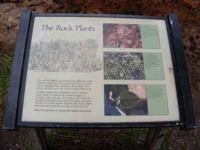
The Rock Plants
Point Reyes National Seashore

Photographed By Don Morfe, July 5, 2009
1. The Rock Plants Marker
Photo captions:
Upper photo:
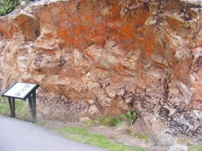
This furry alga (Trentepohlia) grows here on the shadier north face of rocks. Although it contains green chlorophyll, red pigments predominate. Algae such as these, called “rock violets” need no soil.
Center photo:
These pale-green lichens are complex organisms composed of algae and fungi living in association. The fungal part holds onto the rock and absorbs moisture, while the algal part produces food for both.
Lower photo:
The leaves of salal are thick and glossy to retain moisture and withstand wind. Salal grows in depressions and crevices where developing soil accumulates.
On these fogbound, windblown rocks, things a plant needs to survive are in short supply — sun light, soil, and rain. Salt spray and winds can interfere with plant processes and cause excessive drying. Yet some species survive, like the ice plant pictured above and the red alga in front of you.
Please do not pick or disturb the fragile rock plants.
Erected by National Park Service.
Topics. This historical marker is listed in this topic list: Environment.
Location. 37° 59.766′ N, 123° 1.314′ W. Marker is in Inverness, California, in Marin County. Marker can be reached from Sir Francis Drake Boulevard. The marker is located near the Visitor Center at the Point Reyes National Seashore. Touch for map. Marker is at or near this postal address: 27000 Sir Francis Drake Boulevard, Inverness CA 94937, United States of America. Touch for directions.
Other nearby markers. At least 8 other markers are within 3 miles of this marker, measured as the crow flies. Point Reyes Light (within shouting distance of this marker); Common Murres (about 300 feet away, measured in a direct line); Point Reyes Light Station (about 500 feet away); Point Reyes Conglomerate (about 600 feet away); Victims of the Coast (approx. 2.3 miles away); Lives of Sacrifice and Service are Honored Here (approx. 2.3 miles away); Whalewatching (approx. 2.4 miles away); Sea Life in These Waters (approx. 2.4 miles away). Touch for a list and map of all markers in Inverness.
Credits. This page was last revised on June 16, 2016. It was originally submitted on February 16, 2013, by Don Morfe of Baltimore, Maryland. This page has been viewed 437 times since then and 19 times this year. Photos: 1, 2, 3. submitted on February 16, 2013, by Don Morfe of Baltimore, Maryland. • Syd Whittle was the editor who published this page.

