Fort Lauderdale in Broward County, Florida — The American South (South Atlantic)
The Lewis Family
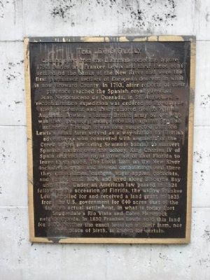
Coming over from the Bahamas sometime before 1792, Suries and Frankee Lewis and their three sons settled on the banks of the New River and were the first permanent settlers of European descent in what is now Broward County. In 1793, after reports of their presence reached the Spanish royal governor, Juan Nepomuceno de Quesada, in St. Augustine, a reconnaissance expedition was ordered to investigate their settlement and their rumored ties to William Augustus Bowles, a former British army officer who was then formenting Indian rebellion against Spanish authority. Though it was long suspected that the Lewis's small farm served as a way-station for British adventurers who consorted with segments of the Creek tribes (including Seminole bands) to subvert Spanish control over the colony, King Charles IV of Spain ordered the royal governor of East Florida to leave them alone. The Lewis farm on the New River included a cabin and several outbuildings and there they raised limes, oranges, sugar apples, coconuts, and guavas until 1824, and lived along Biscayne Bay until 1836. Under an American law passed in 1824 following the accession of Florida, the widow Frankee Lewis applied for and received a land grant in 1825 from the U.S. government for 640 acres east of the family's actual settlement, in what is today Fort Lauderdale's Rio Vista and Colee Hammock neighborhoods. In 1830 Frankee Lewis sold this land for $400. Neither the exact location of their farm, nor their place of birth, is known for certain.
Erected 2006.
Topics. This historical marker is listed in these topic lists: Colonial Era • Exploration • Settlements & Settlers. A significant historical year for this entry is 1792.
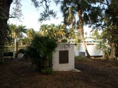
Location. 26° 6.808′ N, 80° 9.199′ W. Marker is in Fort Lauderdale, Florida, in Broward County. Marker is at the intersection of SW 9th Avenue and Coconut Drive when traveling north on SW 9th Avenue. Touch for map. Marker is in this post office area: Fort Lauderdale FL 33315, United States of America. Touch for directions.
Other nearby markers. At least 8 other markers are within walking distance of this marker. The Tequesta (within shouting distance of this marker); Cooley's Massacre (approx. 0.3 miles away); The First Fort Lauderdale (approx. 0.3 miles away); West Side Grade School (approx. half a mile away); Early 19th Century British Admiralty Anchor (approx. 0.6 miles away); Replica 1899 School House (approx. 0.6 miles away); Old Fort Lauderdale Village (approx. 0.6 miles away); Shippey House (approx. 0.6 miles away). Touch for a list and map of all markers in Fort Lauderdale.
Also see . . .
1. Renamed park linked to settlers of New River area. Sun Sentinel article dated April 29, 2010. (Submitted on March 7, 2013, by Cleo Robertson of Fort Lauderdale, Florida.)
2. New River Settlement. Wikipedia article, relating primarily to William Cooley (Submitted on March 7, 2013, by Cleo Robertson of Fort Lauderdale, Florida.)

Photographed By Robert Cole
5. Scenic bend in the New River bordering Lewis Landing Park
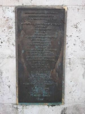
In addition to its commemoration in the name of the first permanent residents of the New River area, this park has been designated as the largest prehistoric site on the New River in various archaeological surveys relating to the Tequesta Indians, who predate the Seminoles, and were probably there before 1000 A.D.
Credits. This page was last revised on October 25, 2021. It was originally submitted on March 7, 2013, by Cleo Robertson of Fort Lauderdale, Florida. This page has been viewed 1,335 times since then and 43 times this year. Photos: 1, 2, 3, 4, 5. submitted on March 7, 2013, by Cleo Robertson of Fort Lauderdale, Florida. • Bill Pfingsten was the editor who published this page.


