Belle and Mayo Islands in Richmond, Virginia — The American South (Mid-Atlantic)
Ironworks Oil House
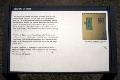
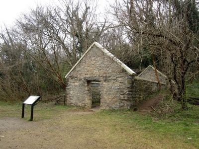
Notice the earth piled around the shed’s side walls. The earth once reached to within two feet of the roof. The thick stone walls, reinforced by the heaped earth, would have helped direct any explosion and fire upward rather than outward, to protect other buildings as well as the workers here.
When the 1934 Robert E. Lee Bridge was demolished after the new bridge was completed in 1988, the shed’s heavy slate roof was removed. The walls were temporarily buried under thirty feet of sand to protect them from any falling debris.
Erected by Richmond National Battlefield Park.
Topics. This historical marker is listed in this topic list: Industry & Commerce. A significant historical year for this entry is 1886.
Location. 37° 31.767′ N, 77° 27.086′ W. Marker is in Richmond, Virginia. It is in Belle and Mayo Islands. Marker can be reached from Tredegar Street, 0.3 miles west of South 5th Street. Located on Belle Isle which can be reached via a pedestrian bridge from the north bank of the river. Touch for map. Marker is at or near this postal address: 470 Tredegar Street, Richmond VA 23219, United States of America. Touch for directions.
Other nearby markers. At least 8 other markers are within walking distance of this marker. Cannon over the Camp (a few steps from this marker); Canons (sic) and Corpses (within shouting distance of this marker); Belle Isle Rolling Milling and Slitting Manufactory (within shouting distance of this marker); Native American Fishing (about 600 feet away, measured in a direct line); Historic Belle Isle (about 600 feet away); Hollywood Rapids (about 600 feet away); The Power of Moving Water (about 700 feet away); Belle Isle Prison Camp Monument (about 700 feet away). Touch for a list and map of all markers in Richmond.
More about this marker. (caption)
Sanborn Insurance Company map, 1886, showing the oil house. Courtesy Library of Virginia.
Credits. This page was last revised on February 1, 2023. It was originally submitted on April 1, 2013, by Bernard Fisher of Richmond, Virginia. This page has been viewed 537 times since then and 20 times this year. Photos: 1, 2. submitted on April 1, 2013, by Bernard Fisher of Richmond, Virginia.

