Near Arad in Tamar Regional Council, Southern District, Israel — West Asia (the Levant in the Middle East)
The Breaching Point
נקודת הפריצה
Inscription.
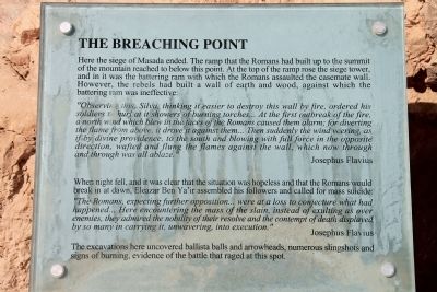
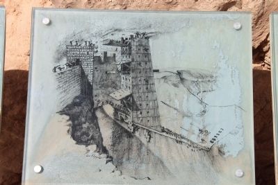
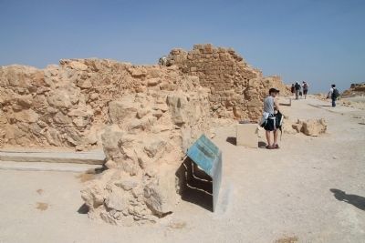
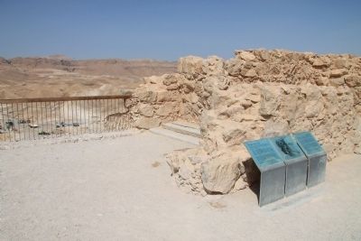
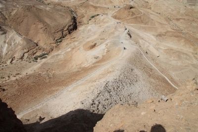
Here the siege of Masada ended. The ramp that the Romans had built up to the summit of the mountain reached to below this point. At the top of the ramp rose the siege tower, and in it was the battering ram with which the Romans assaulted the casemate wall. However, the rebels had built a wall of earth and wood, against which the battering ram was ineffective:
"Observing this, Silva, thinking it easier to destroy this wall by fire, ordered his soldiers to hurl at it showers of burning torches... At the first outbreak of the fire, a north wind which blew in the faces of the Romans caused them alarm; for diverting the flame from above, it drove it against them... Then suddenly the wind veering, as if by divine providence, to the south and blowing with full force in the opposite direction, wafted and flung the flames against the wall, which now through and through was all ablaze."
Josephus Flavius
When night fell, and it was clear that the situation was hopeless and that the Romans would break in at dawn, Eleazar Ben Ya'ir assembled his followers and called for mass suicide:
The Romans, expecting further opposition... were at a loss to conjecture what had happened... Here encountering the mass of the slain, instead of exulting as over enemies, they admired the nobility of their resolve and the contempt of death displayed by so many in carrying it, unwavering, into execution."
Josephus Flavius
The excavations here uncovered ballista balls and arrowheads numerous slingshots and signs of burning, evidence of the battle that raged at this spot.
Topics. This historical marker is listed in these topic lists: Forts and Castles • Patriots & Patriotism.
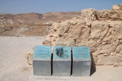
Location. 31° 18.994′ N, 35° 21.162′ E. Marker is near Arad, Southern District, in Tamar Regional Council. Marker can be reached from Masada National Park Service Road just west of National Route 90, on the right when traveling south. This historical marker is located in the ancient Herodian fortification, on top of an isolated rock plateau, on the eastern edge of the Judaean Desert, overlooking the Dead Sea. The historical marker is situated on the western edge of the fortification, in front of the Roman ramp. Touch for map. Touch for directions.
Other nearby markers. At least 8 other markers are within walking distance of this marker. Columbarium Tower (dovecot) (a few steps from this marker); The "Casemate of the Scrolls" (about 90 meters away, measured in a direct line); The Synagogue (about 90 meters away); The Water Gate (about 150 meters away); The Commandant's Residence (about 150 meters away); The Rebel's Community Life
(about 150 meters away); Life in a fortified palace (about 150 meters away); The "Commandant's Headquarters" (about 180 meters away). Touch for a list and map of all markers in Arad.
Also see . . . Masada. This is a link to information provided by Wikipedia, the free encyclopedia. (Submitted on April 1, 2013, by Dale K. Benington of Toledo, Ohio.)
Credits. This page was last revised on May 18, 2023. It was originally submitted on March 29, 2013, by Dale K. Benington of Toledo, Ohio. This page has been viewed 787 times since then and 18 times this year. Last updated on April 1, 2013. Photos: 1, 2. submitted on April 1, 2013, by Dale K. Benington of Toledo, Ohio. 3. submitted on April 12, 2023, by Darren Jefferson Clay of Duluth, Georgia. 4, 5, 6, 7. submitted on April 1, 2013, by Dale K. Benington of Toledo, Ohio. • Bill Pfingsten was the editor who published this page.
