Coalinga in Fresno County, California — The American West (Pacific Coastal)
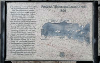
Fredrick Tibbits and Louis O’Neill
1896
Coalinga didn’t really begin to develop until after oil was discovered and the first oil well was brought in, in 1896. Then Fredrick Tibbits opened a saloon, the “Cornet”, and Louis O’Niell built a store. By 1900, Coalinga could boast about two dozen frame buildings. Tent and shanties also dotted the town site. The oil boom began. The town became known as a freewheeling boom town. Front Street, better known as Whiskey Row, had thirteen saloons that all did a rousing business. Many of them were also elaborate gambling dens and sites of many fistfights, brawls and shoot-outs. All the stuff of legendary frontier lore.
Erected by Coalinga Lions Club.
Topics. This historical marker is listed in this topic list: Industry & Commerce. A significant historical year for this entry is 1888.
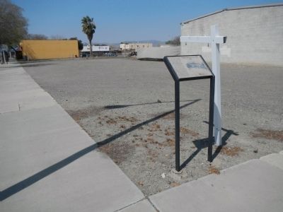
Location. 36° 8.352′ N, 120° 21.55′ W. Marker is in Coalinga , California, in Fresno County. Marker is at the intersection of East Forest Avenue and North 5th Street, on the right when traveling west on East Forest Avenue. Touch for map. Marker is at or near this postal address: 101 East Forest Avenue, Coalinga CA 93210, United States of America. Touch for directions.
Other nearby markers. At least 8 other markers are within walking distance of this marker. A.P. May Inc. (a few steps from this marker); Coalinga’s Notorious Whiskey Row “1909” (a few steps from this marker); Sullivan Hotel (within shouting distance of this marker); Coalinga’s First Rail Station – 1891 (within shouting distance of this marker); Bordagaray’s (within shouting distance of this marker); Crescent Meat Co. (about 300 feet away, measured in a direct line); The Earthquake of 1983 (about 400 feet away); Amy Building (about 400 feet away). Touch for a list and map of all markers in Coalinga.
Credits. This page was last revised on June 16, 2016. It was originally submitted on April 2, 2013, by Barry Swackhamer of Brentwood, California. This page has been viewed 433 times since then and 18 times this year. Photos: 1, 2. submitted on April 2, 2013, by Barry Swackhamer of Brentwood, California. • Syd Whittle was the editor who published this page.

