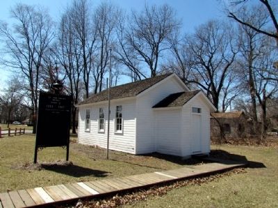
Schererville in Lake County, Indiana — The American Midwest (Great Lakes)
St. John Township School District #2
Erected 1995 by Indiana Historical Bureau and Committee to Save Township School #2. (Marker Number 45.1995.1.)
Topics and series. This historical marker is listed in this topic list: Education. In addition, it is included in the Indiana Historical Bureau Markers series list. A significant historical year for this entry is 1853.
Location. 41° 29.46′ N, 87° 29.289′ W. Marker is in Schererville, Indiana, in Lake County. Marker is on Joliet St (U.S. 30) 0.1 miles east of St. John Rd, on the right when traveling east. Marker is located at entrance to St. John Township Community Center. Touch for map. Marker is at or near this postal address: 1515 Joliet St, Schererville IN 46375, United States of America. Touch for directions.
Other nearby markers. At least 8 other markers are within 4 miles of this marker, measured as the crow flies. The Lincoln Highway / The "Ideal Section" (approx. 0.4 miles away); Lincoln Highway - Ideal Section - 1923 (approx. 0.4 miles away); The Lincoln Highway (approx. half a mile away); The Ideal Section Of The Lincoln Highway (approx. half a mile away); Sauk (Sak) Trail (approx. half a mile away); a different marker also named The Lincoln Highway (approx. 1.1 miles away); a different marker also named The Lincoln Highway / The "Ideal Section" (approx. 1.1 miles away); Sauk Village (approx. 3˝ miles away in Illinois). Touch for a list and map of all markers in Schererville.
Credits. This page was last revised on June 16, 2016. It was originally submitted on April 5, 2013, by Duane Hall of Abilene, Texas. This page has been viewed 538 times since then and 15 times this year. Photos: 1, 2, 3. submitted on April 5, 2013, by Duane Hall of Abilene, Texas. • Bill Pfingsten was the editor who published this page.


