Turner's Creek Landing in Kent County, Maryland — The American Northeast (Mid-Atlantic)
Agricultural Demonstration Area / Historic Tree Grove
Inscription.
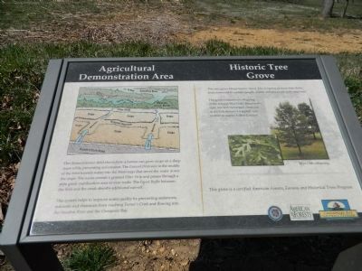
Agricultural Demonstration Area
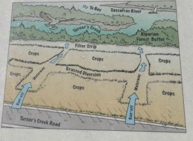
this demonstration field shows how a farmer can grow crops on a steep slope while preventing soil erosion. The Grassed Diversion in the middle of the field funnels water into the Waterways that move the water down the slope. The water crosses a grassed Filter Strip and passes through a pipe grade stabilization area or over rocks. The Forest Buffer between the field and the creek absorbs additional run-off.
This system helps to improve water quality by preventing sediments, nutrients and chemicals from reaching Turner's Creek and flowing into the Sassafras River and the Chesapeake Bay.
Historic Tree Grove
This tree grove brings history alive! The offspring of more than thirty trees connected to famous people, events and places are cultivated here.
The grove features two offspring of the famous Wye Oak - Maryland's state tree and the largest white oak in the U.S. (before it toppled over in 2002 in nearby Talbot County).
This grove is a certified American Forests, Famous and Historical Trees Program.
Erected by Chesapeake Bay Gateways Network.
Topics. This historical marker is listed in these topic lists: Agriculture • Horticulture & Forestry. A significant historical year for this entry is 2002.
Location. 39° 21.333′ N, 75° 59.097′ W. Marker is in Turner's Creek Landing, Maryland, in Kent County. Marker is on Turners Creek Road, on the right when traveling south. Marker is .1 mile south of the end of Turners Creek Road. Touch for map. Marker is in this post office area: Kennedyville MD 21645, United States of America. Touch for directions.
Other nearby markers. At least 8 other markers are within walking distance of this marker. Natural Diversity at Turner's Creek (about 300 feet away, measured in a direct line); A Home with a Rich Past (about 400 feet away); Captain John Smith on the Sassafras River (about 400 feet away); The Tockwogh and the Bay (about 400 feet away); Turner's Creek (approx. 0.2 miles away); Waterfront Hub for Trade (approx. 0.2 miles away); Reluctant Aide (approx. 0.2 miles away); Welcome to the Kent Museum (approx. ¼ mile away). Touch for a list and map of all markers in Turner's Creek Landing.
Credits. This page was last revised on December 19, 2020. It was originally submitted on April 12, 2013, by Bill Pfingsten of Bel Air, Maryland. This page has been viewed 379 times since then and 21 times this year. Last updated on December 18, 2020, by Carl Gordon Moore Jr. of North East, Maryland. Photos: 1, 2, 3. submitted on April 12, 2013, by Bill Pfingsten of Bel Air, Maryland.


