Turner's Creek Landing in Kent County, Maryland — The American Northeast (Mid-Atlantic)
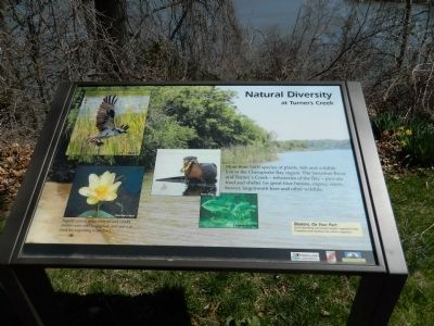
Natural Diversity at Turner's Creek
Aquatic plants in local rivers and creeks shelter crabs and young fish, and serve as food for migrating waterfowl.
Boaters, Do Your Part:
Avoid disturbing submerged aquatic vegetation beds. Propellers and impellers can uproot vegetation.
Erected by Chesapeake Bay Gateways Network.
Topics. This historical marker is listed in these topic lists: Animals • Environment.
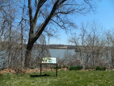
Location. 39° 21.282′ N, 75° 59.067′ W. Marker is in Turner's Creek Landing, Maryland, in Kent County. Marker can be reached from Turners Creek Road. Marker is on the grounds of Knock's Folly. Touch for map. Marker is in this post office area: Kennedyville MD 21645, United States of America. Touch for directions.
Other nearby markers. At least 8 other markers are within walking distance of this marker. A Home with a Rich Past (a few steps from this marker); Captain John Smith on the Sassafras River (within shouting distance of this marker); The Tockwogh and the Bay (within shouting distance of this marker); Agricultural Demonstration Area / Historic Tree Grove (about 300 feet away, measured in a direct line); Welcome to the Kent Museum (approx. 0.2 miles away); Turner's Creek (approx. 0.2 miles away); Waterfront Hub for Trade (approx. 0.2 miles away); Reluctant Aide (approx. ¼ mile away). Touch for a list and map of all markers in Turner's Creek Landing.
Credits. This page was last revised on June 16, 2016. It was originally submitted on April 12, 2013, by Bill Pfingsten of Bel Air, Maryland. This page has been viewed 352 times since then and 13 times this year. Photos: 1, 2. submitted on April 12, 2013, by Bill Pfingsten of Bel Air, Maryland.

