Beaumont in Jefferson County, Texas — The American South (West South Central)
The Lucas Gusher
Inscription.
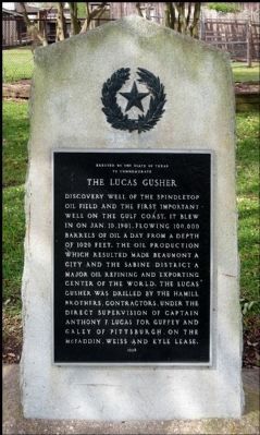
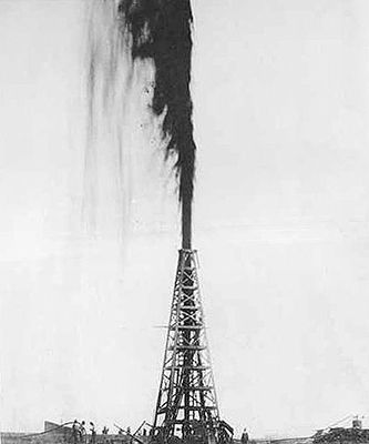
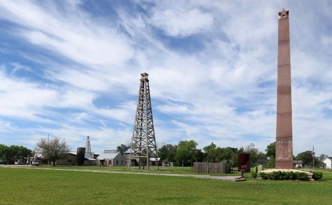
Discovery well of the Spindletop Oil Field and the first important well on the Gulf Coast. It blew in on Jan. 10, 1901, flowing 100,000 barrels of oil a day from a depth of 1020 feet. The oil production which resulted made Beaumont a city and the Sabine District a major oil refining and exporting center of the world. The Lucas Gusher was drilled by the Hamill Brothers, contractors, under the direct supervision of Captain Anthony F. Lucas for Guffey and Galey of Pittsburgh, on the McFaddin, Weiss and Kyle lease.
Erected 1936 by The State of Texas. (Marker Number 10540.)
Topics and series. This historical marker is listed in this topic list: Industry & Commerce. In addition, it is included in the Texas 1936 Centennial Markers and Monuments series list. A significant historical month for this entry is January 1817.
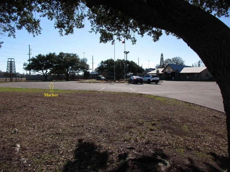
Location. 30° 1.945′ N, 94° 4.721′ W. Marker is in Beaumont, Texas, in Jefferson County. Marker can be reached from the intersection of Jimmy Simmons Boulevard (University Drive) and East Cardinal Drive (Business U.S. 96), on the right when traveling south. Marker is at the Spindletop-Gladys City Boomtown Museum. Touch for map. Marker is in this post office area: Beaumont TX 77705, United States of America. Touch for directions.
Other nearby markers. At least 8 other markers are within 4 miles of this marker, measured as the crow flies. Site Of Spindle Top Hill Confederate Camp (approx. 1.2 miles away); Harry James' Childhood Homesite (approx. 2.7 miles away); Jefferson County Courthouse (approx. 3.3 miles away); Port of Beaumont (approx. 3.3 miles away); Saint Anthony's Cathedral (approx. 3.4 miles away); William G. "Bill" Hall (approx. 3˝ miles away); Henry Millard (approx. 3˝ miles away); Beaumont (approx. 3˝ miles away). Touch for a list and map of all markers in Beaumont.
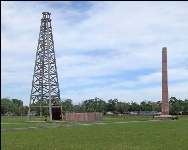
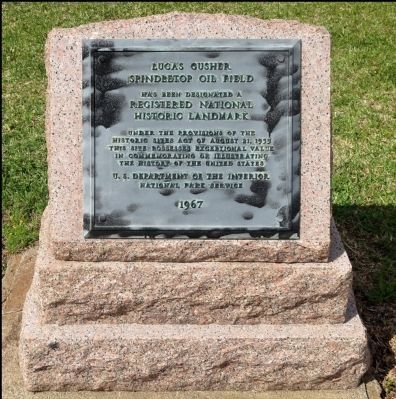
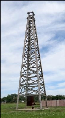
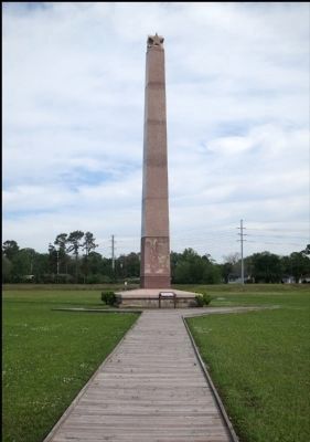
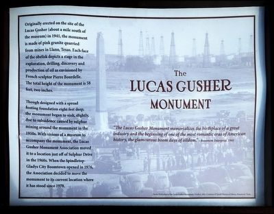
More about this marker. Strangely the marker is beside the parking lot at the museum which it about 1.5 miles north of the where the well was. The monument (see pictures) was originally at the well location but has been moved twice. The first of these moves was because of ground movement, the second to put it on the museum site.
Regarding The Lucas Gusher. Spindletop was the largest gusher the world had seen and catapulted Beaumont, Texas into an oil-fueled boomtown. The strike at Spindletop represented a turning point for Texas and the United States; no oil field in the world had ever been so productive. The frenzy of oil exploration and the economic development it generated in the state became known as the Texas Oil Boom. The United States soon became the world's leading oil producer.
During the Spindletop oil boom, six hundred oil companies hastily incorporated and sold stock. All but two became financial flops. Only Texaco and Gulf Refining Co. (Gulf Oil, now Chevron) survived the boomtown frenzy to become major oil companies.
Also see . . .
1. The Lucas Gusher in Wikipedia. (Submitted on April 14, 2013, by Jim Evans of Houston, Texas.)
2. Spindletop and the Lucas Gusher in the Texas Handbook. (Submitted on April 14, 2013, by Jim Evans of Houston, Texas.)
3. A Recreation of the Lucas Gusher Using Water Instead of Oil (video). YouTube (Submitted on April 14, 2013, by Jim Evans of Houston, Texas.)
4. 122 Pictures From the Spindletop-Gladys City Boomtown Museum. Click on the 'Next' button at the top right of the pictures to move to the next picture (Submitted on April 14, 2013, by Jim Evans of Houston, Texas.)
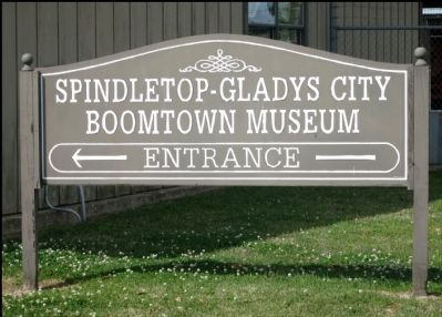
Photographed By Jim Evans, April 13, 2013
10. Sign
The Spindletop-Gladys City Boomtown Museum commemorates the discovery of oil at the Spindletop Hill salt dome in Beaumont on Jan. 10, 1901. Along with a gift shop with commemorative gifts, the museum features historical, period reenactments by area performers
Photographed By Jim Evans, April 13, 2013
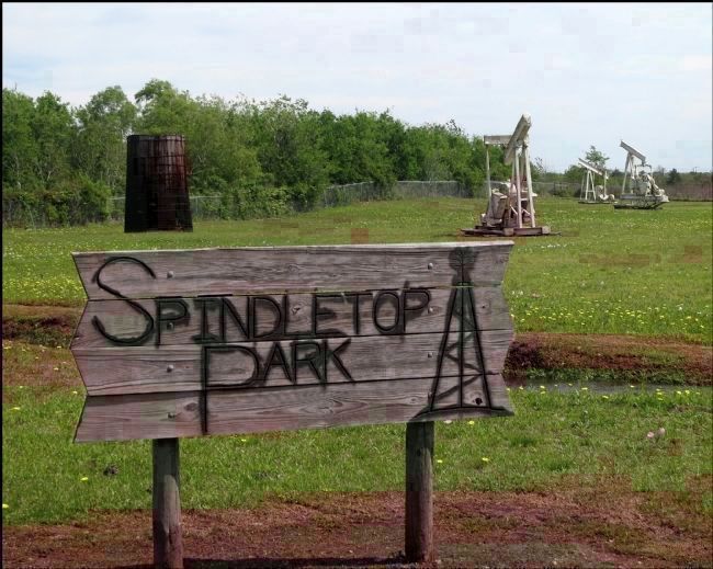
13. Spindletop Park -- the Actual Location of the Lucas Gusher
This park is located at North 30° 00.718 West 94° 04.626.
Note gunbarrel behind park sign. The oil and salt water that comes out of the ground with it are put in the gunbarrel where the oil and water separate. The oil floats to the top or the water sinks to the bottom, however you like to think of it.
Though the Lucas Gusher was actually located here there's no plaque, no small monument, no flag no marker of any sort to indicate this. There's not even a sign on the main road showing where to turn off to reach this remote place.
A mile and a half north of here, at the museum, they make a big deal of the gusher that created Beaumont, made Texas "the oil state" and the U.S. the oil capital of the world but they seem to completely ignore the actual site of the world famous gusher. Well, they named the park Spindletop. But, Spindletop was the giant oil field that developed from gusher. They didn't name it Lucas park or something that indicates it's the famous place.
This is all completely baffling to me.
It had rained a day or so ago (see water in ditch behind sign) and I was wearing sandals, so I must confess I didn't walk across the squishy ground to see if one of the old pumpers had something on the far side of it.
Credits. This page was last revised on January 23, 2024. It was originally submitted on April 14, 2013, by Jim Evans of Houston, Texas. This page has been viewed 2,363 times since then and 243 times this year. It was the Marker of the Week January 10, 2016. Photos: 1. submitted on April 14, 2013, by Jim Evans of Houston, Texas. 2. submitted on January 23, 2024, by Jeff Leichsenring of Garland, Texas. 3, 4, 5, 6, 7, 8, 9, 10, 11, 12, 13. submitted on April 14, 2013, by Jim Evans of Houston, Texas. • Bernard Fisher was the editor who published this page.
