Near Bertrand in Berrien County, Michigan — The American Midwest (Great Lakes)
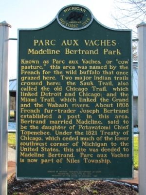
Parc Aux Vaches
Madeline Bertrand Park
Erected 1987 by Bureau of History, Michigan Department of State. (Marker Number L1363C.)
Topics and series. This historical marker is listed in these topic lists: Native Americans • Roads & Vehicles • Settlements & Settlers. In addition, it is included in the Michigan Historical Commission series list. A significant historical year for this entry is 1808.
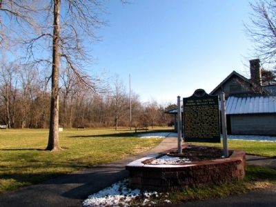
Location. 41° 45.783′ N, 86° 16.179′ W. Marker is near Bertrand, Michigan, in Berrien County. Marker can be reached from Adams Road, 0.3 miles north of State Line Road, on the left when traveling north . The marker is located in Madeline Bertrand Park next to the visitor center. The park charges an admission fee for entry. Touch for map. Marker is at or near this postal address: 3038 Adams Rd, Niles MI 49120, United States of America. Touch for directions.
Other nearby markers. At least 8 other markers are within 4 miles of this marker, measured as the crow flies. Bertrand (approx. 0.9 miles away); St. Joseph's Mission (approx. 1.1 miles away); La Salle's Camp (approx. 2˝ miles away in Indiana); Robert Rene Cavalier Sieur DeLaSalle (approx. 3.4 miles away in Indiana); Fort St. Joseph (approx. 3˝ miles away); Father Claude Jean Allouez S. J. (approx. 3.6 miles away); Council Oak (approx. 3.6 miles away in Indiana); Portage Prairie United Methodist Church (approx. 3.9 miles away). Touch for a list and map of all markers in Bertrand.
Related markers. Click here for a list of markers that are related to this marker. The list includes other historical markers about the Chicago Road in Michigan.
Credits. This page was last revised on June 16, 2016. It was originally submitted on December 13, 2012, by Duane Hall of Abilene, Texas. This page has been viewed 883 times since then and 45 times this year. Last updated on April 19, 2013, by Duane Hall of Abilene, Texas. Photos: 1, 2. submitted on December 13, 2012, by Duane Hall of Abilene, Texas. • Bernard Fisher was the editor who published this page.

