Canandaigua in Ontario County, New York — The American Northeast (Mid-Atlantic)
City of Canandaigua
History Happened Here
— The Business District —
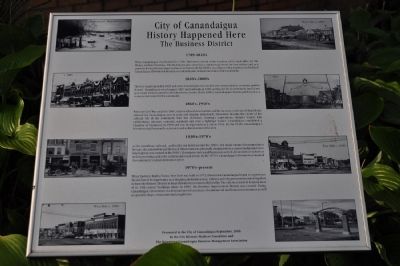
When Canandaigua was founded in 1789, Downtown served as the location at the land office for the Phelps-Gorham Purchase. The Downtown also served as a commercial center for new settlers and as a stopover for travelers in stagecoaches or on horses. By the 1820s, a corduroy or log roadway was built and Canandaigua's Downtown became a residential and commercial center of the community.
The Erie Canal opened in 1825 and since Canandaigua was not directly connected to it, economic growth slowed. Steamboat service began in 1827 and railroads in 1836 serving our local community, but did not spur major business growth until later in the century. By the 1860's, Canandaigua's Downtown thrived as a commercial center for the community.
When the Civil War ended in 1865, major railroad construction and the increase in the use of steamboats allowed the Canandaigua area to grow and develop industrially. Downtown became the center of the cultural life of the community with two churches, firemen's conventions, Ontario County Fair celebrations, circuses, concerts, carnivals and even a tightrope walker. Canandaigua established a Chamber of Commerce in 1909 and was incorporated as a city in 1913. By the 1930's Canandaigua's Downtown had become the economic and cultural center of the area.
As the steamboat, railroad, and trolley era faded around the 1930's the major means of transportation became the automobile and the truck. Downtown was physically changed when a center median and a two lane highway was created in the 1950's. Downtown stores and businesses served city and area residents as well as providing a place for cultural and social events. By the 1970's, Canandaigua's Downtown remained the community's center destination point.
When Eastview Mall in Victor, New York was built in 1971, Downtown Canandaigua began to experience the decline of its importance as a shopping destination stop. Citizens and city government joined together to form the Historic District to keep Downtown economically healthy. The city succeeded in keeping most of its 19th century buildings intact. In 1992, the Business Improvement District was created. Today, Canandaigua's Downtown is a destination with a mixture of commercial and financial institutions as well as specialty shops, restaurants and art galleries.
Topics. This historical marker is listed in these topic lists: Industry & Commerce • Settlements & Settlers. A significant historical year for this entry is 1789.
Location. 42° 53.119′ N, 77° 16.796′ W. Marker is in Canandaigua, New York, in Ontario County. Marker is on South Main Street (New York State Route 332) near Coach Street. Touch for map. Marker is in this post office area: Canandaigua NY 14424, United States of America. Touch for directions.
Other nearby markers. At least 8 other markers are within walking distance of this marker. Historic Canandaigua Public Square (approx. 0.2 miles away); The Last General Council of the United States (approx. 0.2 miles away); 200 Years of Peace and Friendship (approx. 0.2 miles away); Austin Steward (approx. 0.3 miles away); Haudenosaunee Family (approx. half a mile away); Routes of the Armies of General John Sullivan and General James Clinton 1779 (approx. ¾ mile away); Granger Homestead (approx. 0.9 miles away); Boathouse History (approx. one mile away). Touch for a list and map of all markers in Canandaigua.
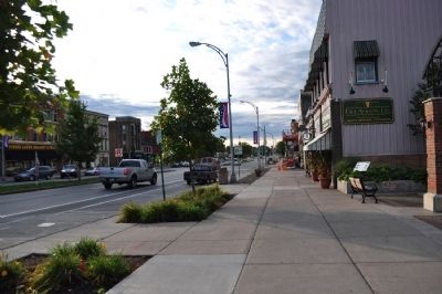
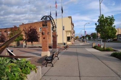
More about this marker. As can be seen in the pictures, this marker is a bit obscured by some of the plants in this pocket park. It is also nearly impossible to see when approached from the south.
Credits. This page was last revised on June 16, 2016. It was originally submitted on April 20, 2013, by Yugoboy of Rochester, New York. This page has been viewed 688 times since then and 27 times this year. Photos: 1, 2, 3. submitted on April 20, 2013, by Yugoboy of Rochester, New York. • Bill Pfingsten was the editor who published this page.


