Yorktown in York County, Virginia — The American South (Mid-Atlantic)
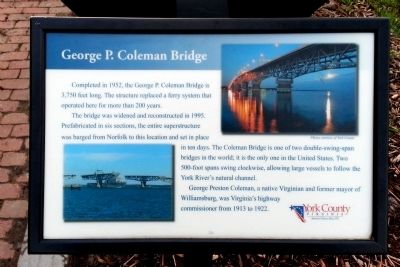
George P. Coleman Bridge
The bridge was widened and reconstructed in 1995. Prefabricated in six sections, the entire superstructure was barged from Norfolk to this location and set in place in ten days. The Coleman Bridge is one of two double-swing-span bridges in the world; it is the only one in the United States. Two 500-foot spans swing clockwise, allowing large vessels to follow the York River’s natural channel.
George Preston Coleman, a native Virginian and former mayor of Williamsburg, was Virginia’s highway commissioner from 1913 to 1922.
Photos courtesy of York County.
Erected 2010 by York County.
Topics. This historical marker is listed in this topic list: Bridges & Viaducts. A significant historical year for this entry is 1952.
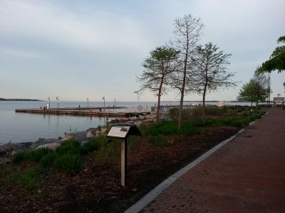
Location. 37° 14.361′ N, 76° 30.541′ W. Marker is in Yorktown, Virginia, in York County. Marker can be reached from Water Street west of Buckner Street, on the right when traveling west. Located along Yorktown's Riverwalk. Touch for map. Marker is in this post office area: Yorktown VA 23690, United States of America. Touch for directions.
Other nearby markers. At least 8 other markers are within walking distance of this marker. Yorktown's Tea Party (here, next to this marker); N.S. Savannah (within shouting distance of this marker); Nick's Seafood Pavilion (within shouting distance of this marker); The Olympic Flame (within shouting distance of this marker); Chesapeake Bay Watermen (within shouting distance of this marker); York River Ferry (within shouting distance of this marker); Heavy Artillery at Yorktown (about 300 feet away, measured in a direct line); Wars & Yorktown (about 300 feet away). Touch for a list and map of all markers in Yorktown.
Credits. This page was last revised on November 14, 2021. It was originally submitted on April 21, 2013, by Bernard Fisher of Richmond, Virginia. This page has been viewed 425 times since then and 21 times this year. Photos: 1, 2. submitted on April 21, 2013, by Bernard Fisher of Richmond, Virginia.

