Niagara Falls in Niagara Region, Ontario — Central Canada (North America)
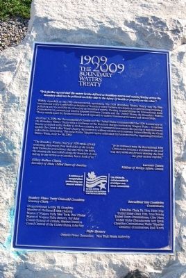
The Boundary Waters Treaty
Widely regarded as the first environmental agreement, the 1909 Boundary Waters Treaty was the first international treaty to articulate principles of boundary water resource development, to address cross-boundary pollution and to prohibit the diversion of boundary waters. Further, in establishing the International Joint Commission to prevent and resolve disputes between Canada and the United States, the Boundary Waters Treaty stands apart for its uncommonly good approach to natural resource governance and stewardship.
On June 13, 2009, the Governments of Canada and the United States commemorated the 100th Annversary of the Boundary Waters Treaty with a ceremony on the Rainbow Bridge overlooking Niagara Falls - its natural beauty protected under Article V. At that occasion, the Governments announced the opening of negotiations to update the Great Lakes Water Quality Agreement to address modern environmental issues affecting the Great Lakes Basin Ecosystem. The cross-border Niagara region celebrated this historic event by organizing Boundary Waters Week, June 4-14, 2009.
"The Boundary Waters Treaty of 1909 made official something that people from both sides of the border have known for generations: that the rivers, the lakes, the streams, the watersheds along our boundary do not belong to one nation or to another, but to both of us."
Hillary Rodham Clinton
Secretary of State, United States of America
"In its centenary year, the International Joint Commission remains a testament to the good will, hard work and forward thinking that bind our great nations together."
Lawrence Cannon
Minister of Foreign Affairs, Canada
A century of cooperation protecting our shared waters (logo) Un siecle de collaboration a proteger nos eaux communes
Boundary Waters Treaty Centennial Honorary Chairs
Congresswoman Louise M. Slaughter
Member of Parliament Rick Dykstra
Mayor of Niagara Falls, New York, Paul Dyster
Mayor of Niagara Falls, Ontario, Ted Salci
Consul General of Canada, Stephen Brereton
Consul General of the United States, John Nay
International Joint Commission Commissioners
Canadian Chair, Rt. Hon. Herb Gray
United States Chair, Hon. Irene Brooks
United States Commissioner, Allen Olsen
United States Commissioner, Sam Speck
Canadian Commissioner, Pierre Trepanier
Canadian Commissioner, Lyall Knott
Erected by Ontario Power Generation - New York Power Authority.
Topics. This historical marker is listed in these topic lists: Environment • Waterways & Vessels. A significant historical month for this entry is June 1607.
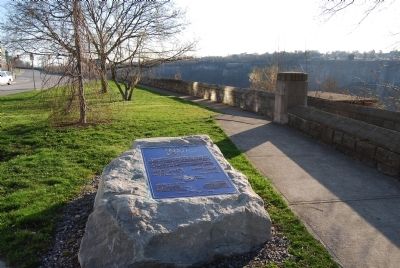
Location. 43° 5.529′ N, 79° 4.109′ W. Marker is in Niagara Falls, Ontario, in Niagara Region. Marker is on River Road, 0.2 kilometers south of Hiram Street, on the right when traveling north. Located underneath the Rainbow Bridge. Touch for map. Marker is in this post office area: Niagara Falls ON L2E 7M7, Canada. Touch for directions.
Other nearby markers. At least 8 other markers are within walking distance of this marker. International Rainbow Bridge Commemoration (about 120 meters away, measured in a direct line); Rainbow Bridge (about 150 meters away); Upper Suspension Bridge (approx. 0.3 kilometers away); Upper Steel Arch Bridge (approx. 0.3 kilometers away); Thomas Baker McQuesten (approx. 0.4 kilometers away); The Falls View Bridges (approx. 0.4 kilometers away in the U.S.); Welcome to Schoellkopf Power Station No.3 (approx. 0.4 kilometers away in the U.S.); Bridges of Niagara (approx. half a kilometer away in the U.S.). Touch for a list and map of all markers in Niagara Falls.
Credits. This page was last revised on September 27, 2019. It was originally submitted on April 21, 2013, by Mike Wintermantel of Pittsburgh, Pennsylvania. This page has been viewed 580 times since then and 22 times this year. Photos: 1, 2. submitted on April 21, 2013, by Mike Wintermantel of Pittsburgh, Pennsylvania.

