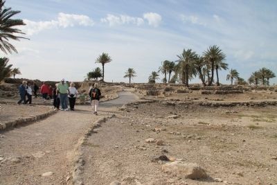
Near Megiddo, Haifa District, Israel — West Asia (the Levant in the Middle East)
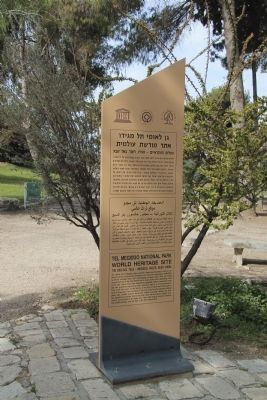
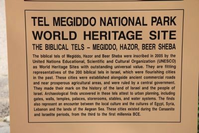
Tel Megiddo National Park
World Heritage Site
— The Biblical Tels - Megiddo, Hazor, Beer Sheba —
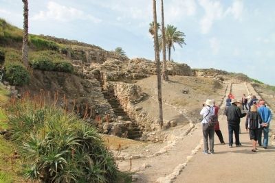
The biblical tels of Megiddo, Hazor and Beer Sheba were inscribed in 2005 by the United Nations Educational, Scientific and Cultural Organization (UNESCO) as World Heritage Sites with outstanding universal value. They are fitting representatives of the 200 biblical tels in Israel, which were flourishing cities in the past.These cities were established alongside ancient commercial roads and near prosperous agricultural areas, and were ruled by a central government. They made their mark on the history of the land of Israel and the people of Israel. Archaeological finds uncovered in these tels attest to urban planning, including gates, walls, temples, palaces, storerooms, stables, and water systems. The finds also represent an encounter between the local culture and the cultures of Egypt, Syria, Lebanon and the lands of the Aegean Sea. These cities existed during the Canaanite and Israelite periods, from the third to the first millennia BCE.
Topics and series. This historical marker is listed in these topic lists: Anthropology & Archaeology • Forts and Castles • Settlements & Settlers. In addition, it is included in the Tel Megiddo, and the UNESCO World Heritage Sites series lists. A significant historical year for this entry is 2005.
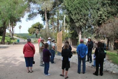
Location. 32° 35.187′ N, 35° 11.134′ E. Marker is near Megiddo, Haifa District. Marker can be reached from National Route 66 just north of National Route 65, on the left when traveling north. This historical marker is located in the Megiddo National Park. The park is located between the Megiddo and Yokne‘am junctions (road no. 66), about 2 km west of the Megiddo junction. The historical marker is situated just beyond the visitor center and parking lot, at the beginning of the footpath that takes visitors to the archaeological park at the top of Tel Megiddo. Touch for map. Touch for directions.
Other nearby markers. At least 8 other markers are within walking distance of this marker. From Megiddo to Armageddon (a few steps from this marker); The Northern Stables (about 90 meters away, measured in a direct line); The Northern Palace (about 90 meters away); The Sacred Area (about 120 meters away); A Unique Continuity (about 120 meters away); The City-Gate (about 120 meters away); a different marker also named The City-Gate (about 120 meters away); Schumaker's Excavations (about 180 meters away). Touch for a list and map of all markers in Megiddo.
Related markers. Click here for a list of markers that are related to this marker. To better understand the relationship, study each marker in the order shown.
Also see . . .
1. Tel Megiddo. This is a link to information provided by Wikipedia, the free encyclopedia. (Submitted on April 26, 2013, by Dale K. Benington of Toledo, Ohio.)
2. The Megiddo Expedition. This is a link to information provided by The Megiddo Expedition Website. (Submitted on April 26, 2013, by Dale K. Benington of Toledo, Ohio.)
3. Tell Megiddo. This is a link to information provided by the BibleWalks,com website. (Submitted on April 26, 2013, by Dale K. Benington of Toledo, Ohio.)
4. Tel Meggiddo. This is a link to information provided by BibleWalks.com. (Submitted on May 10, 2013, by Dale K. Benington of Toledo, Ohio.)
Credits. This page was last revised on December 27, 2023. It was originally submitted on April 26, 2013, by Dale K. Benington of Toledo, Ohio. This page has been viewed 882 times since then and 9 times this year. Photos: 1, 2, 3, 4, 5, 6, 7. submitted on April 26, 2013, by Dale K. Benington of Toledo, Ohio.
