Near Midland City in Dale County, Alabama — The American South (East South Central)
The Block House/River Port - Fort - Ferry
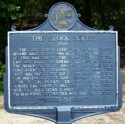
The Block House
1814
The first public structure in what later became Dale County was erected one mile east of this marker at the confluence of the East and West Choctawhatchee Rivers. Called the Block House, it was built of logs by a contingent of Jackson’s Army in 1814. This post was not fortified, it provided shelter for militia and settlers driven into it by fear of Indians. The site of a ferry across the river, it was occupied as a store and was designated a Post Office from 1833 to 1841. First postmaster was John Whitehurst.
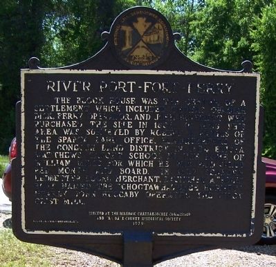
(Back):
River Port – Fort – Ferry
The Block House was the center of a settlement which included Thomas Obadiah Dick, ferry operator, and John Beverett who purchased the site in 1836. In 1823 this area was surveyed by Robert D. Harris of the Spatz Land Office, Headquarters of the Conecuh Land District. In 1824 Elisha Matthews taught school in the home of William Mills for which he was paid $10.00 per month and board. In 1827 Seaborn Ledbetter, local merchant, launched a “pole” boat named the “Choctawhatchee Hornet”. Nearby John Huccaby operated the first grist mill.
Erected 1979 by Historic Chattahoochee Commission and the Dale County Historical Society.
Topics. This historical marker is listed in this topic list: Settlements & Settlers. A significant historical year for this entry is 1814.
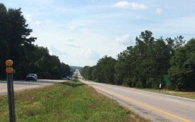
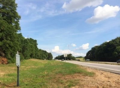
Location. 31° 20.993′ N, 85° 33.263′ W. Marker is near Midland City, Alabama, in Dale County. Marker is on U.S. 231, on the right when traveling north. Touch for map. Marker is in this post office area: Midland City AL 36350, United States of America. Touch for directions.
Other nearby markers. At least 8 other markers are within 7 miles of this marker, measured as the crow flies. The Mack M. Matthews School (approx. 2.4 miles away); Baptist Collegiate Institute (approx. 2.8 miles away); Newton (approx. 3.1 miles away); Newton Confederate Memorial (approx. 3.1 miles away); The Hanging of Bill Sketoe (approx. 3.4 miles away); Town of Midland City (approx. 4.2 miles away); Christian Hill Cemetery (approx. 6.6 miles away); Richmond - First County Seat Henry County / Richmond - First County Seat Dale County (approx. 7 miles away). Touch for a list and map of all markers in Midland City.
More about this marker. Located north of Ozark, AL at Newtown, AL which appears on road signs but not on any map.
Credits. This page was last revised on December 19, 2016. It was originally submitted on April 28, 2013, by David J Gaines of Pinson, Alabama. This page has been viewed 2,552 times since then and 195 times this year. Photos: 1, 2. submitted on April 28, 2013, by David J Gaines of Pinson, Alabama. 3, 4. submitted on June 5, 2014, by Mark Hilton of Montgomery, Alabama. • Craig Swain was the editor who published this page.


