Cowarts in Houston County, Alabama — The American South (East South Central)
Cowarts Baptist Church / Cowarts School
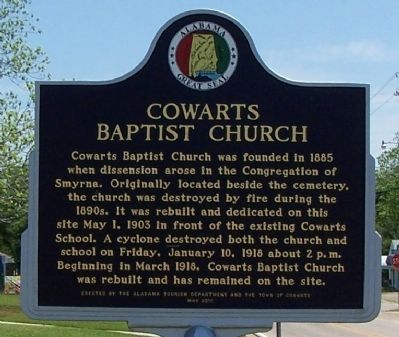
Cowarts Baptist Church
Cowarts Baptist Church was founded in 1885 when dissension arose in the Congregation of Smyrna. Originally located beside the cemetery, the church was destroyed by fire during the 1890s. It was rebuilt and dedicated on this site May 1, 1903 in front of the existing Cowarts School. A cyclone destroyed both the church and school on Friday, January 10, 1918 about 2 p.m. Beginning in March 1918, Cowarts Baptist Church was rebuilt and has remained on the site.
(Back):
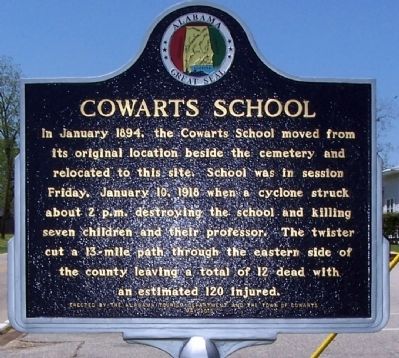
Cowarts School
In January 1894, the Cowarts School moved from its original location beside the cemetery and relocated to this site. School was in session Friday, January 10, 1918 when a cyclone struck about 2 p.m. destroying the school and killing seven children and their professor. The twister cut a 13-mile path through the eastern side of the county leaving a total of 12 dead with an estimated 120 injured.
Erected 2010 by Alabama Tourism Department and the Town of Cowarts.
Topics. This historical marker is listed in these topic lists: Churches & Religion • Disasters • Education. A significant historical date for this entry is January 10, 1817.
Location. 31° 12.023′ N, 85° 18.341′ W. Marker is in Cowarts , Alabama, in Houston County. Marker is on Jordon Street, on the right when traveling west. Touch for map. Marker is in this post office area: Cowarts AL 36321, United States of America. Touch for directions.
Other nearby markers. At least 8 other markers are within 6 miles of this marker, measured as the crow flies. Ashford Depot (approx. 4.2 miles away); Ashford Centennial (approx. 4.3 miles away); Incorporation of Ashford/Ashford - a Unique Name (approx. 4.3 miles away); Ashford United Methodist Church (approx. 4.4 miles away); Cherry Street African Methodist Episcopal Church (approx. 5.2 miles away); The Naming of Dothan (approx. 5.2 miles away); Marvin Holman (approx. 5.2 miles away); Dothan Municipal Light and Water Plant (approx. 5.2 miles away).
Regarding Cowarts Baptist Church / Cowarts School. Located at the right, front of the church lawn.
Credits. This page was last revised on January 1, 2017. It was originally submitted on April 28, 2013, by David J Gaines of Pinson, Alabama. This page has been viewed 948 times since then and 34 times this year. Photos: 1, 2. submitted on April 28, 2013, by David J Gaines of Pinson, Alabama. • Craig Swain was the editor who published this page.

