Near Ranchos de Taos in Taos County, New Mexico — The American Mountains (Southwest)
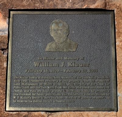
William J. Klauer
February 15, 1909 – February 21, 2001
— In Honor and Memory of —
Topics. This historical marker is listed in these topic lists: Charity & Public Work • Settlements & Settlers. A significant historical month for this entry is March 1780.
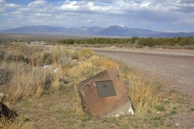
Location. 36° 18.493′ N, 105° 43.873′ W. Marker is near Ranchos de Taos, New Mexico, in Taos County. Marker is on State Road 68 at milepost 33.6, on the left when traveling north. It is across the road from the Taos Valley Overlook picnic pulloff. Touch for map. Marker is in this post office area: Ranchos de Taos NM 87557, United States of America. Touch for directions.
Other nearby markers. At least 8 other markers are within 11 miles of this marker, measured as the crow flies. Captive Women and Children of Taos County / María Rosa Villapando, (ca. 1725-1830) (within shouting distance of this marker); Pilar (approx. 4.2 miles away); Maria Ramita Simbola Martinez "Summer Harvest" (1884-1969) (approx. 7½ miles away); San Francisco de Asis Church (approx. 7.7 miles away); Pueblo of Picuris (approx. 8.2 miles away); Taos (approx. 10.3 miles away); The Harwood Museum (approx. 10.9 miles away); Kenneth Adams (approx. 10.9 miles away). Touch for a list and map of all markers in Ranchos de Taos.
Also see . . . Taos Valley Overlook. The Trust for Public Land page. “For generations, travelers cresting this scenic overlook south of Taos have been greeted by sweeping views of the Sangre de Cristo Mountains and the Rio Grande River gorge. The family that owns this land along Route 68 has kept it in pristine condition since 1915, but for years conservationists have been looking for a way to protect it permanently from development. TPL worked with its partner, the Taos Land Trust, to help the Bureau of Land Management acquire the property for the Orilla Verde Recreation Area. The BLM will manage the land to preserve the view and wildlife habitat and to expand opportunities for low impact recreational activities such as hiking, fishing, and picnicking.” (Submitted on April 29, 2013, by J. J. Prats of Powell, Ohio.)
Credits. This page was last revised on April 26, 2020. It was originally submitted on April 29, 2013, by J. J. Prats of Powell, Ohio. This page has been viewed 666 times since then and 39 times this year. Photos: 1, 2. submitted on April 29, 2013, by J. J. Prats of Powell, Ohio.

