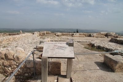
Near Megiddo, Haifa District, Israel — West Asia (the Levant in the Middle East)
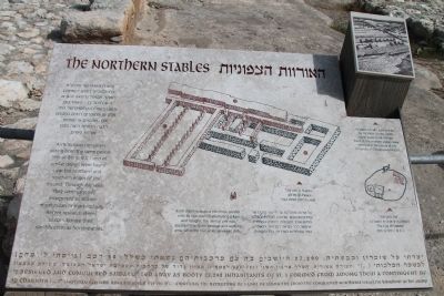
The Northern Stables
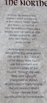
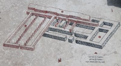
Architectural complexes dating from the same period (9th or 8th c. B.C.) and of similar design were found near the northern and southern edges of the mound. Through the years they variously interpreted as stables, storehouses or marketplaces. Recent research seems to corroborate their identification as horse-stables.
[Text across the Bottom of the Marker]:
"I besieged and conquered Samaria. Led away as booty 27,290 inhabitants of it. I formed from among them a contingent of 50 chariots (...)" (Assyrian records, King Sargon II (721-705 B.C.) mentions the recruiting o) a unit of chariotry from the conquered Northern Israelite Kingdom in his army).
Topics and series. This historical marker is listed in these topic lists: Anthropology & Archaeology • Forts and Castles • Settlements & Settlers. In addition, it is included in the Tel Megiddo series list.
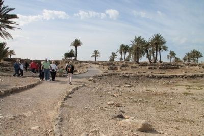
Location. 32° 35.147′ N, 35° 11.102′ E. Marker is near Megiddo, Haifa District. Marker can be reached from National Route 66, 0 kilometers north of National Route 65, on the left when traveling north. This historical marker is located in the Megiddo National Park. The park is located between the Megiddo and Yokne‘am junctions (road no. 66), about 2 km west of the Megiddo junction. The historical marker is situated at the top of Tel Megiddo, on the north side, between the city-gate and the north palace. Touch for map. Touch for directions.
Other nearby markers. At least 8 other markers are within walking distance of this marker. The Northern Palace (a few steps from this marker); The Sacred Area (within shouting distance of this marker); A Unique Continuity (within shouting distance of this marker); From Megiddo to Armageddon (within shouting distance of this marker); The City-Gate (within shouting distance of this marker); Schumaker's Excavations (about 90 meters away, measured in a direct line); Tel Megiddo National Park (about 90 meters away); a different marker also named The City-Gate (about 90 meters away). Touch for a list and map of all markers in Megiddo.
More about this marker. The "Megiddo National Park" handout/brochure has this to say about Stop 6, "The Northern Stables" on the historic tour:
Two stable complexes were found at Megiddo - one on the northeastern part of the mound and one in the southwest. They reveal Megiddo's importance as a cavalry base or a center for commerce in horses. The construction of the stable-city is attributed to one of the Israelite kings, perhaps Jeroboam II, in the eighth century BCE or to King Ahab, in the ninth century BCE. Some scholars believe that the stables were used
for other purposes - as storehouses, markets, or army barracks. On the left, part of a stable can be seen, including pillars and mangers. This northern part of the complex included 12 stables; the southern part was removed by the Chicago expedition to reach the level of the Early Canaanite period (the Early Bronze Age). The Tel Aviv University expedition completed the excavation of the stables and uncovered an impressive portion of the southern facade of the northernmost stables, which is slated for conservation and reconstruction. Additional stables were discovered on the southern part of the mound (16). The stable walls were built of mudbrick on a foundation of ashlars. some of which were probably robbed from the ruined northern palace (7). The large number of stables attests to a strong city government at the time they were built and to Megiddo's status as a major chariot city.
Related markers. Click here for a list of markers that are related to this marker. To better understand the relationship, study each marker in the order shown.
Also see . . .
1. Tel Megiddo. This is a link to information provided by Wikipedia, the free encyclopedia. (Submitted on April 29, 2013, by Dale K. Benington of Toledo, Ohio.)
2. The Megiddo Expedition. This is a link to information provided by The Megiddo Expedition Website.
(Submitted on April 29, 2013, by Dale K. Benington of Toledo, Ohio.)
3. Tell Megiddo. This is a link to information provided by the BibleWalks.com website. (Submitted on April 29, 2013, by Dale K. Benington of Toledo, Ohio.)
4. Sargon II. This is a link to information provided by Wikipedia, the free encyclopedia. (Submitted on May 9, 2013, by Dale K. Benington of Toledo, Ohio.)
Credits. This page was last revised on December 14, 2023. It was originally submitted on April 29, 2013, by Dale K. Benington of Toledo, Ohio. This page has been viewed 664 times since then and 20 times this year. Photos: 1. submitted on April 29, 2013, by Dale K. Benington of Toledo, Ohio. 2, 3, 4, 5. submitted on April 30, 2013, by Dale K. Benington of Toledo, Ohio.
