Scottsville in Monroe County, New York — The American Northeast (Mid-Atlantic)
Genesee Valley Greenway
Scottsville & Genesee River Canal
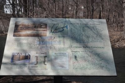
In the 1830s, farmers and businessmen built a railroad and canal to get their crops, gypsum, and flour from the mills in Caledonia, Mumford, Wheatland Center, and Garbutt to the Genesee River, Rochester, and the Erie Canal. In 1838, they constructed the Scottsville and LeRoy Railroad from Caledonia to Scottsville mill yard on the west bank of Oatka Creek. Products from the railroad cars were unloaded onto boats which traveled east on Oatka Creek until it met the Scottsville and Genesee River Canal. Boats followed the canal to the Genesee River. To increase the amount of water available for the canal, a wooden dam was constructed in Oatka Creek. Remains of the dam's stone abutments are still visible in the creek, and remnants of a later guard gate mark the canal's intersection with Oatka Creek.
Genesee Valley Canal
When the Genesee Valley Canal was opened in 1840, the State closed the Scottsville and Genesee River Canal, took possession of its guard lock and dam, and converted a portion of the canal to supply water to the New Genesee Valley Canal. The new canal forever changed Scottsville’s economy. The Scottsville and LeRoy Railroad closed and, river boating and the operation of warehouses on the Genesee River ceased. After 1840, warehouses, a planing mill, and a lumber and coal yard sprang up at the intersection of the canals and Oatka Creek.
A dam across Oatka Creek created a reservoir that supplied water to the canal through a guard gate. From the Emily and Hayward Madden Collection, courtesy Canal Society of New York State.
The Scottsville Aqueduct was built to carry the Genesee Valley Canal across Oatka Creek Foundation stones are still visible along the creek bank where the iron railroad bridge rests on the old aqueduct abutment. There are no visible remains of Genesee Valley Canal Lock #3, which was located just north of the aqueduct. Courtesy New York State Archives.
The **st side of the bulkhead (feeder guard gate structure) of the Genesee Valley Canal as it appeared in 2003. Courtesy Fran Gotcsik, Lima, NY.
The Scottsville Canal's original guard lock was replaced with a single set of guard gates, sometimes called a bulkhead, which was necessary to control water between the creek and the canal. This drawing is a generic plan of a Genesee Valley Canal bulkhead. Courtesy New York State Archives.
An 1872 broadside advertising Wheatland Plaster, which was an important commodity transported from Wheatland via the canal. Courtesy of Wheatland Town Historian.
Topics. This historical marker is listed in these topic lists: Industry & Commerce • Railroads & Streetcars • Waterways & Vessels. A significant historical year for this entry is 1838.
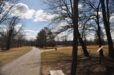
Location. 43° 1.146′ N, 77° 44.815′ W. Marker is in Scottsville, New York, in Monroe County. Marker can be reached from Rochester Street (Route 251) ¼ mile south of Main Street (Route 383). Marker is deep within a park. It is close to the Genesee Valley Greenway, which is a multi-use trail that runs from Rochester in the north past Letchworth State Park in the south. Touch for map. Marker is in this post office area: Scottsville NY 14546, United States of America. Touch for directions.
Other nearby markers. At least 8 other markers are within walking distance of this marker. A different marker also named Genesee Valley Greenway (about 300 feet away, measured in a direct line); Feeder Gates (about 400 feet away); Canal Street (about 600 feet away); Mill Site Area of Historic Scottsville (approx. ¼ mile away); Northampton (approx. ¼ mile away); First House (approx. ¾ mile away); Site of Early School (approx. one mile away); Erected 1834 (approx. one mile away). Touch for a list and map of all markers in Scottsville.
Credits. This page was last revised on June 16, 2016. It was originally submitted on May 1, 2013, by Yugoboy of Rochester, New York. This page has been viewed 467 times since then and 19 times this year. Photos: 1, 2. submitted on May 1, 2013, by Yugoboy of Rochester, New York. • Bill Pfingsten was the editor who published this page.

