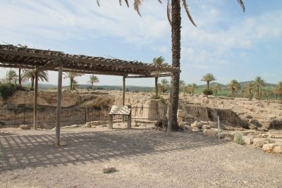
Near Megiddo, Haifa District, Israel — West Asia (the Levant in the Middle East)
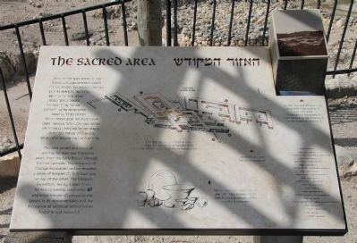
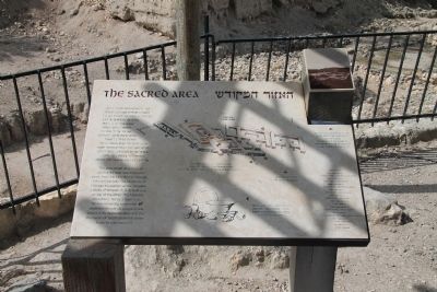
The Sacred Area
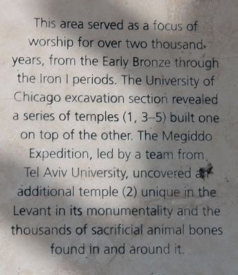
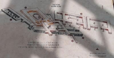
This area served as a focus of worship for over two thousand years, from the Early Bronze through the Iron I periods. The University of Chicago excavation section a series of temples (1, 3-5) built one on top of the other. The Megiddo Expedition, led by a team from Tel Aviv University, uncovered an additional temple (2) unique in the Levant in its monumentality and the thousands of sacrificial animal bones found in and around it.
[Text on the Right Side of the Marker]:
7000-3500 B.C.
Neolithic & Chalcolithic
3500-2200 B.C.
Early Bronze
2200-2000 B.C.
Intermediate Bronze
2000-1550 B.C.
Middle Bronze
1500-1150 B.C.
Late Bronze
1150-1000/900 B.C.
Iron I
1000/900 - 732 B.C.
Iron II (Israelite)
732-586 B.C.
Iron II (Assyrian, Egyptian)
586-530 B.C.
Babylonian
530-332 B.C.
Persian
Topics and series. This historical marker is listed in these topic lists: Anthropology & Archaeology • Churches & Religion • Settlements & Settlers. In addition, it is included in the Tel Megiddo series list.
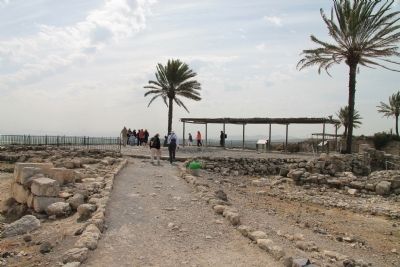
Location. 32° 35.126′ N, 35° 11.132′ E. Marker is near Megiddo, Haifa District. Marker can be reached from National Route 66 just north of National Route 65, on the left when traveling north. This historical marker is located in the Megiddo National Park. The park is located between the Megiddo and Yokne‘am junctions (road no. 66), about 2 km west of the Megiddo junction. The historical marker is situated at the top of Tel Megiddo, on the eastern side, on the northern crest of the broad and deep archaeological trench dug into Tel Megiddo by the University of Chicago's excavation team. Touch for map. Touch for directions.
Other nearby markers. At least 8 other markers are within walking distance of this marker. A Unique Continuity (here, next to this marker); The Northern Palace (within shouting distance of this marker); The Northern Stables (within shouting distance of this marker); Schumaker's Excavations (about 90 meters away, measured in a direct line); From Megiddo to Armageddon (about 90 meters away); Tel Megiddo National Park (about 120 meters away); A Public Grain Silo (about 120 meters away); The Southern Palace (about 120 meters away). Touch for a list and map of all markers in Megiddo.
More about this marker. The "Megiddo National Park" handout/brochure has this to say about Stop 9, "The temple area" on the historic tour:
The deep trench visible from the observation point was dug by the Chicago expedition. In
the far section of the trench, opposite the observation point, the mound's numerous strata can be seen - more than 20 cities - excavated down to bedrock. Remains found in a depression in the bedrock go back as far as the Neolithic period. Finds from the Early Canaanite period indicate the presence of a large un-walled settlement that stretched east toward the present-day road at the foot of the mound.
Below, you can see Megiddo's cultic area from the fourth millennium BCE to the beginning of the Israelite period. In the Early Canaanite period, a series of temples was built here continuously, one atop the other. The earliest, dating from the Early Canaanite period IB, was a broadroom structure with an enclosed courtyard. Paving stones discovered in the courtyard bore incised Egyptian-style motifs, among them depictions of humans and animals.
Another temple from later in this period is the most monumental structure of its time known in the Levant. Impressive, finely finished basalt offering tables were sunken into its floor. Its four-meter thick walls reveal the importance of the site as early at the end of the fourth millennium BCE. This temple illustrates the process of urbanization underway in Canaan at the close of the fourth millennium BCE.
At the end of the Early Canaanite period (2300 BCE), three more temples were built over the earlier ones. They
Photographed By Dale K. Benington, March 8, 2013
3. The Sacred Area Marker
Close-up view of the illustration showing the various "sacred compounds," from the different periods of history, displayed on the historic marker. Temples (1) (2) date to the Early Bronze I Period, Temples (3) (4) date to the Early Bronze III Period, and Temple (5) dates to the Middle Bronze to Iron I Period. Note the "Round Altar" seen in the illustration.
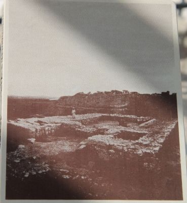
At the beginning of the Middle Canaanite period rites were performed in the open area. At the end of that period, the fortress-like 'Tower Temple' (dismantled by the Chicago expedition) was built over the remains of the above-mentioned three temples. Featuring thick walls and an entrance flanked by a pair of towers, the 'Tower Temple' continued in use until the end of the Israelite period I.
With the complete destruction of the Canaanite city in the Israelite period I, cultic practices ceased in the temple area after over 2,000 years.
Regarding The Sacred Area. The text on this historical marker shares two different views on when the Iron I Period ended (either 1,000 or 900 B.C.) and when the Iron II Period began (once again, either 1,000 or 900 B.C.). These two different views are the result of the current split in scholars of Biblical archaeology and history into two camps identified as minimalists
and maximalists. I have included two links to help the reader to understand what the significant issues are in these two differing views.
It should be noted that this debate in view points is focused on the period in Ancient Near History from about 1,000 to 800 B.C. (the time period that this historical marker's timeline falls into) and that the debate is centered around matching the historical timeline of the literature found in the text of the Bible with the historical timeline of the archaeological evidence being found in the lands and physical sites associated with the Bible.
The author of one of these links (who is pro minimalist) writes, "Maximalism and Minimalism: labels for two opinions about the relation between written evidence and archaeology, which sometimes are conflicting...The labels 'maximalism' and 'minimalism' were coined in the debate about the historical reliability of the Bible. For more than a century, archaeologists have been digging in the Near East, and inevitably, they found contradictions between the archaeological record and the story told in the Bible...'Minimalism' and 'maximalism' are two principles to cope with this situation. Maximalist scholars assume that the Biblical story is more or less correct, unless archaeologists prove that it is not; minimalists assume that the Biblical story must be read as fiction, unless it can be
Photographed By Dale K. Benington, March 8, 2013
5. The Sacred Area Marker
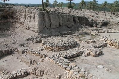
View of photo displayed as part of the historical marker with the following caption: "The remains of this temple (5) were removed by the University of Chicago Expedition." The round altar, from earlier temple structures, would be directly beneath this structure.
The author of the other link (who is pro maximalist) writes, "According to the minimalists, the United Monarchy never split into two kingdoms, Judah and Israel, because it never existed in united form in the first place. Their account is that the two kingdoms developed side by side, with the Kingdom of Judah and its capital, Jerusalem, developing at a far later stage, after the consolidation of the Kingdom of Israel in the ninth and eighth centuries BCE. In this interpretation, David and Solomon are entirely fictional figures."
Related markers. Click here for a list of markers that are related to this marker. To better understand the relationship, study each marker in the order shown.
Also see . . .
1. Tel Megiddo. This is a link to information provided by Wikipedia, the free encyclopedia. (Submitted on May 2, 2013, by Dale K. Benington of Toledo, Ohio.)
2. The Megiddo Expedition. This is a link to information provided by The Megiddo Expedition Website. (Submitted on May 2, 2013, by Dale K. Benington of Toledo, Ohio.)
3. Tell Megiddo. This is a link to information provided by the BibleWalks.com website. (Submitted on May 2, 2013, by Dale K. Benington of Toledo, Ohio.)
Credits. This page was last revised on April 30, 2023. It was originally submitted on May 2, 2013, by Dale K. Benington of Toledo, Ohio. This page has been viewed 688 times since then and 18 times this year. Photos: 1, 2, 3, 4, 5, 6, 7, 8, 9. submitted on May 3, 2013, by Dale K. Benington of Toledo, Ohio.
