Near Sharpsburg in Washington County, Maryland — The American Northeast (Mid-Atlantic)
Longstreet's Command
Garnett's Brigade, Jones' Division
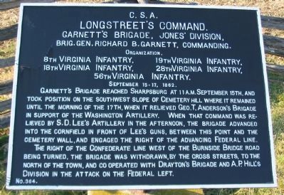
Longstreet's Command.
Garnett's Brigade, Jones' Division,
Brig. Gen. Richard B. Garnett, Commanding.
Organization.
8th Virginia Infantry, 19th Virginia Infantry,
18th Virginia Infantry, 28th Virginia Infantry,
56th Virginia Infantry.
September 15-17, 1862.
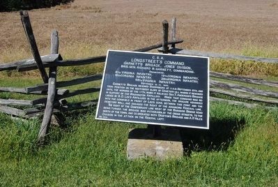
Garnett's Brigade reached Sharpsburg at 11 a.m. September 15th, and took position on the southwest slope of Cemetery Hill where it remained until the morning of the 17th, when it relieved Geo. T. Anderson's Brigade in support of the Washington Artillery. When that command was relieved by S.D. Lee's Artillery in the afternoon, the brigade advanced into the cornfield in front of Lee's guns, between this point and the cemetery wall, and engaged the right of the advancing Federal Line.
The right of the Confederate line west of the Burnside Bridge road being turned, the brigade was withdrawn, by the cross streets, to the north of the town, and co operated with Drayton's Brigade and A.P. Hill's Division in the attack on the Federal left.
Erected by Antietam Battlefield Board. (Marker Number 364.)
Topics and series. This historical marker is listed in this topic list: War, US Civil. In addition, it is included in the Antietam Campaign War Department Markers series list. A significant historical month for this entry is September 1922.
Location. 39° 27.534′ N, 77° 44.205′ W. Marker is near Sharpsburg, Maryland, in Washington County. Marker is on Rodman Avenue, on the right when traveling south. Touch for map. Marker is in this post office area: Sharpsburg MD 21782, United States of America. Touch for directions.
Other nearby markers. At least 8 other markers are within walking distance of this marker. 50th Pennsylvania Volunteer Infantry (within shouting distance of this marker); Ninth Army Corps (within shouting distance of this marker); Fifth Army Corps (approx. 0.2 miles away); a different marker also named Fifth Army Corps (approx. 0.2 miles away); a different marker also named Longstreet's Command (approx. 0.2 miles away); Willcox's Division, Ninth Army Corps (approx. 0.2 miles away); a different marker also named Ninth Army Corps (approx. 0.2 miles away); Companies G. I. and K., 4th U.S. Infantry (approx. ¼ mile away). Touch for a list and map of all markers in Sharpsburg.
Also see . . .
1. Antietam Battlefield. National Park Service site. (Submitted on March 23, 2008, by Craig Swain of Leesburg, Virginia.)
2. Garnett's Brigade. Garnett's Brigade was also known by the name of the previous commander, George Pickett, who was recovering from wounds at the time of the battle. Garnett was later named permanent commander, when Pickett was promoted to take over D.R. Jones' Division. The Brigade went into action here at Antietam with less than 500 men as the effective strength. (Submitted on March 23, 2008, by Craig Swain of Leesburg, Virginia.)
3. Richard B. Garnett. Richard Brooke Garnett (November 21, 1817 – July 3, 1863) was a career United States Army officer and a Confederate general in the American Civil War. He was killed during Pickett's Charge at the Battle of Gettysburg. (Submitted on September 30, 2015, by Brian Scott of Anderson, South Carolina.)
Photographed By Craig Swain, February 9, 2008
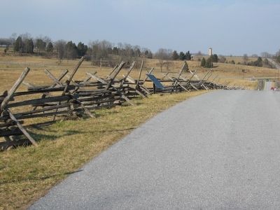
3. Tablet Number 364 along Rodman Avenue
Note the Observation Tower on the Sunken Road in the distance. In the afternoon of the battle, when this sector became active, Garnett's Brigade was advancing a skirmish line in the fields on the west (left) side of the Sherrick's Farm Lane, which followed a similar course to the modern day Rodman Avenue. Elements of the U.S. Regulars were similarly advancing skirmishers through the fields to the east (left) of the lane.
Photographed By Craig Swain, February 9, 2008
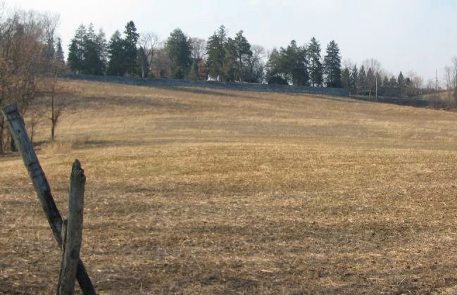
5. Garnett's Skrimish Line
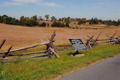
With artillery supporting them from the hill now occupied by the National Cemetery (the wall of which is seen in the background), portions of Garnett's Brigade advanced forward in skirmish order across the corn field which stood in the foreground here. The 8th and 18th Virginia lead the Confederate advance into the fields. In this little studied section of the battlefield, a very spirited fight developed.
Credits. This page was last revised on October 25, 2017. It was originally submitted on March 23, 2008, by Craig Swain of Leesburg, Virginia. This page has been viewed 726 times since then and 11 times this year. Photos: 1. submitted on March 23, 2008, by Craig Swain of Leesburg, Virginia. 2. submitted on September 30, 2015, by Brian Scott of Anderson, South Carolina. 3. submitted on March 23, 2008, by Craig Swain of Leesburg, Virginia. 4. submitted on September 30, 2015, by Brian Scott of Anderson, South Carolina. 5. submitted on March 23, 2008, by Craig Swain of Leesburg, Virginia.
