Medicine Lodge in Barber County, Kansas — The American Midwest (Upper Plains)
Medicine Lodge Stockade
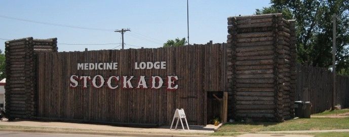
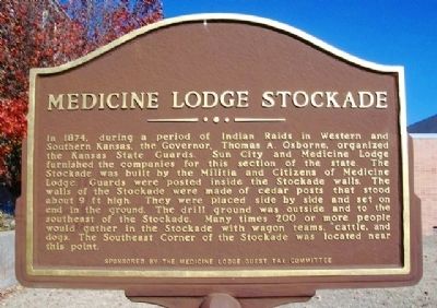
In 1874, during a period of Indian Raids in Western and Southern Kansas, the Governor, Thomas A. Osborne, organized the Kansas State Guards. Sun City and Medicine Lodge furnished the companies for this section of the state. The Stockade was built by the Militia and Citizens of Medicine Lodge. Guards were posted inside the Stockade walls. The walls of the Stockade were made of cedar posts that stood about 9 ft high. They were placed side by side and set on end in the ground. The drill ground was outside and to the southeast of the Stockade. Many times 200 or more people would gather in the Stockade with wagon teams, cattle, and dogs. The Southeast Corner of the Stockade was located near this point.
Erected by the Medicine Lodge Guest Tax Committee.
Topics. This historical marker is listed in these topic lists: Forts and Castles • Settlements & Settlers • Wars, US Indian. A significant historical year for this entry is 1874.
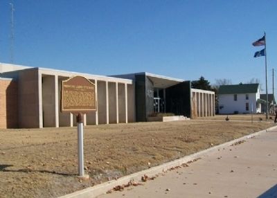
Location. 37° 16.775′ N, 98° 34.692′ W. Marker is in Medicine Lodge, Kansas, in Barber County. Marker is on Washington Avenue east of Main Street, on the left when traveling east. Marker is on the south grounds of the county courthouse. Touch for map. Marker is at or near this postal address: 120 East Washington Avenue, Medicine Lodge KS 67104, United States of America. Touch for directions.
Other nearby markers. At least 8 other markers are within 10 miles of this marker, measured as the crow flies. The Grand Hotel (about 300 feet away, measured in a direct line); The First National Bank (about 500 feet away); Peace Treaty Memorial (approx. 0.2 miles away); Barber County Veterans Memorial (approx. ¼ mile away); Carry Nation Home (approx. 0.3 miles away); Veterans Memorial (approx. 1.1 miles away); Medicine Lodge Peace Treaties (approx. 1.6 miles away); Gypsum Hills Scenic Byway (approx. 9.4 miles away). Touch for a list and map of all markers in Medicine Lodge.

via Medicine Lodge Stockade Museum, unknown
3. Medicine Lodge Stockade Museum
Museum website homepage
Click for more information.
Click for more information.
Credits. This page was last revised on December 24, 2021. It was originally submitted on May 8, 2013, by William Fischer, Jr. of Scranton, Pennsylvania. This page has been viewed 659 times since then and 24 times this year. Photos: 1, 2. submitted on May 8, 2013, by William Fischer, Jr. of Scranton, Pennsylvania. 3. submitted on December 24, 2021, by Larry Gertner of New York, New York.

