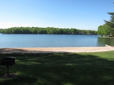
Lake of the Woods in Orange County, Virginia — The American South (Mid-Atlantic)
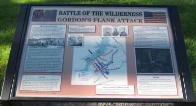
Gordon's Flank Attack
Battle of the Wilderness
From this site, you would have seen Confederate Brig. Gen. John B. Gordon quietly assembled ten regiments between here and the woods, across the lake, at Madison Cir.
In those woods, Union Brig. Gen. T. Seymour had ordered his brigade and that of Brig. Gen. A. Shaler "to make small fires and cook coffee" and they both rode off to Maj. Gen. John Sedgwick's 6th Corps headquarters near Spotswood Park.
Suddenly, the long line of gray-clad soldiers appeared and opened fire. They charged by Madison Cir., along Creekside Dr. and up to a mile down the Union line. Within a few minutes, they had killed or captured most of Seymour's and Shaler's brigade and panicked much of Sedgwick's 6th Corps.
The three Union generals, upon hearing the shots and yells, rode to the battle. Shaler, on the fastest horse, was the first captured by Lt. C.M. Compton of the 31st Georgia Infantry and a dozen of his company near Nugget Dr. Soon thereafter, Compton was shot while capturing Seymour. Sedgwick was rallying his troops around the Culpeper Mine Road when a Confederate officer leveled his pistol at him and shouted, "Surrender, you Yankee SOB." Before the Confederate could fire, a New York trooper shot him dead.
At Sunset
The 10th Vermont Infantry check the Confederate advance along a line from Creekside Dr. to the sixth tee box on the golf course. The 10th Vermont Infantry chaplain wrote that their colonel and that of the 106th New York Infantry had their regiments rise up in front of Gordon's regiments and "give three cheers as only soldiers can give them." This yelling caused the Confederates to halt their charge.
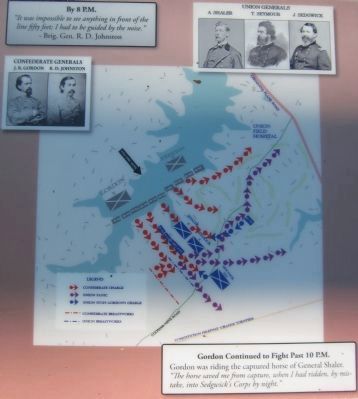
By 8 P.M.
"It was impossible to see anything in front of the line fifty feet; I had to be guided by the noise."
-Brig. Gen. R.D. Johnston
After Dusk on a Moonless Night
The battle spread down the Culpeper Mine Road and all its connecting paths, all the way to the Germanna Plank Road, now Route 3.
Brig. Gen. R.D. Johnston's Brigade, consisting of four North Carolina infantry regiments, lost connection with the Georgian regiments. Johnston rode into a Pennsylvania regiment, but he escaped.
Realizing that Yankees were re-forming in force nearby, Johnston ordered his men back to their starting point. His officers reported that they came in sight of the wagon trains (on the Germanna Plank Road) and would have charged upon them, had they not been recalled at this time, which was as darkness was setting in.
Gordon Continued to Fight Past 10 PM
Gordon was riding the captured horse of General Shaler. "The horse saved me from capture, when I had ridden, by mistake, into Sedgwick's Corps by night."
Midnight
Lt. Gen. U.S. Grant restored order and removed his troops from Lake of the Woods to a new trench line behind Eastover Parkway.
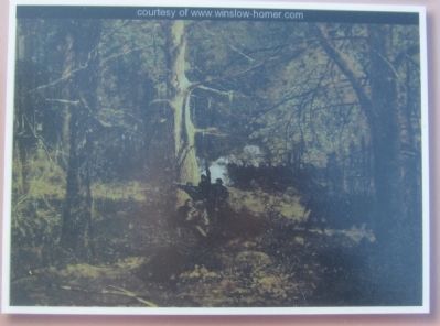
"About 3 A.M. of May 7th, we started to find the battalion. Parties came straggling in all day. Some never came back., (They were) either killed or wounded and burning up in the terrible fire which swept the wood.
Thus ended the Battle of the Wilderness for us and the army."
-Col. H.C. Kirk, 4th New York Heavy Artillery
Erected 2011 by Civil War Study Group and Lake of the Woods, Virginia.
Topics and series. This historical marker is listed in this topic list: War, US Civil. In addition, it is included in the Former U.S. Presidents: #18 Ulysses S. Grant series list. A significant historical month for this entry is May 1876.
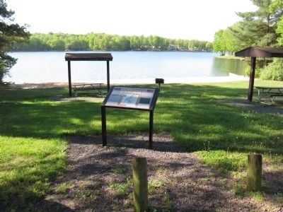
Location. 38° 20.142′ N, 77° 46.072′ W. Marker is in Lake of the Woods, Virginia, in Orange County. Marker is on Cornwallis Avenue, on the right when traveling east. Marker is located at a park in Lake of the Woods Community, a gated community. Visitors must register to visit the marker. . Touch for map. Marker is in this post office area: Locust Grove VA 22508, United States of America. Touch for directions.
Other nearby markers. At least 8 other markers are within walking distance of this marker. A different marker also named Gordon's Flank Attack (approx. 0.7 miles away); Dedicated To The Fallen (approx. 0.7 miles away); From Wilderness Run To Flat Run (approx. 0.7 miles away); Wilderness Battlefield Memorial (approx. 0.7 miles away); Gordon's Attack Falters (approx. 0.8 miles away); John Gordon Proposes a Flank Attack (approx. 0.8 miles away); Fighting on the Evening of May 5, 1864 (approx. 0.8 miles away); Morning of May 6 (approx. 0.9 miles away). Touch for a list and map of all markers in Lake of the Woods.
Credits. This page was last revised on June 16, 2016. It was originally submitted on May 12, 2013, by Craig Swain of Leesburg, Virginia. This page has been viewed 866 times since then and 11 times this year. Photos: 1, 2, 3, 4, 5. submitted on May 12, 2013, by Craig Swain of Leesburg, Virginia.
