Laurel in Prince George's County, Maryland — The American Northeast (Mid-Atlantic)
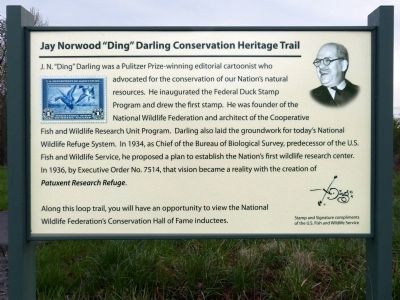
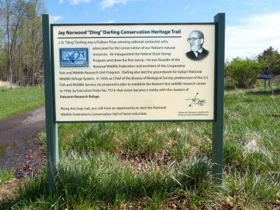
Jay Norwood "Ding" Darling Conservation Trail
Inscription.
J. N. "Ding" Darling was a Pulitzer Prize-winning editorial cartoonist who advocated for the conservation of our Nation's natural resources. He inaugurated the Federal Duck Stamp Program and drew the first stamp. He was founder of the National Wildlife Federation and architect of the Cooperative Wildlife Refuge System. In 1934, as Chief of the Bureau of Biological Survey, predecessor of the U.S. Fish and Wildlife Service, he proposed a plan to establish the Nation's first wildlife research center. In 1936, by executive Order No. 7514, that vision became a reality with the creation of Patuxent Research Refuge.
Along this loop trail, you will have an opportunity to view the National Wildlife Federation's Hall of Fame Inductees.
Erected by U.S. Fish and Wildlife Service, U.S. Department of the Interior.
Topics. This historical marker is listed in these topic lists: Arts, Letters, Music • Environment. A significant historical year for this entry is 1934.
Location. 39° 1.66′ N, 76° 47.87′ W. Marker is in Laurel, Maryland, in Prince George's County. Marker can be reached from Powder Mill Road. The marker and the trail are near the U.S. Fish and Wildlife Service, National Wildlife Visitor Center, 10901 Scarlet Tanager Loop, Laurel, MD 20708-4027. Touch for map. Marker is in this post office area: Laurel MD 20708, United States of America. Touch for directions.
Other nearby markers. At least 8 other markers are within 4 miles of this marker, measured as the crow flies. Dr. Gregory J. Smith (here, next to this marker); National Wildlife Center (within shouting distance of this marker); The Bowie Caboose (approx. 1.7 miles away); From Huntington to Bowie - The History (approx. 1.7 miles away); Bowie Railroad Station Museum (approx. 1.7 miles away); Benjamin Banneker Hall / Benjamin Banneker (approx. 2.1 miles away); Bowie State University (approx. 2.1 miles away); Moon Tree (approx. 3.6 miles away).
Also see . . . Editorial Cartoons by Ding Darling. The Cowles Library at Drake University (Submitted on May 18, 2013, by Allen C. Browne of Silver Spring, Maryland.)
Additional keywords. Conservation
Credits. This page was last revised on October 2, 2022. It was originally submitted on May 18, 2013, by Allen C. Browne of Silver Spring, Maryland. This page has been viewed 576 times since then and 10 times this year. Photos: 1, 2, 3. submitted on May 18, 2013, by Allen C. Browne of Silver Spring, Maryland. • Bill Pfingsten was the editor who published this page.


