Miami in Miami-Dade County, Florida — The American South (South Atlantic)
Brickell Park
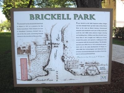
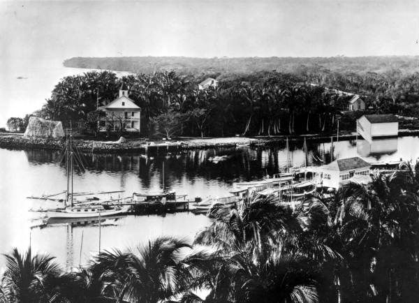
From 700 BC to AD 1000 Tequesta Indian villages ran from Brickell Point up both sides of the Miami River as far west as Miami Avenue. Constructed mounds and cemeteries were part of the landscape until the mid 1880s when pioneers began clearing and building there. William and Mary Brickell came from Ohio in 1871, bought over 1000 acres of land around the point, and opened a trading post that was popular with the Seminole Indians. The Brickells opened a post office here in 1874 and played a prominent role in the early development of Miami. In 2005-2006 the Archaeological and Historical Conservancy uncovered thousands of artifacts from the area in and around Brickell Park.
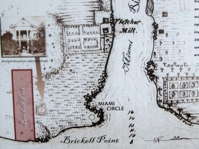
(Image: Map with below heading, and labels which follow)
Map from an 1849 Survey by F.H. Gerdes
· Miami River
· Fletcher Mill
· Fort Dallas
· Burial Mound
· Miami Circle
· Brickell Point
· Brickell Park
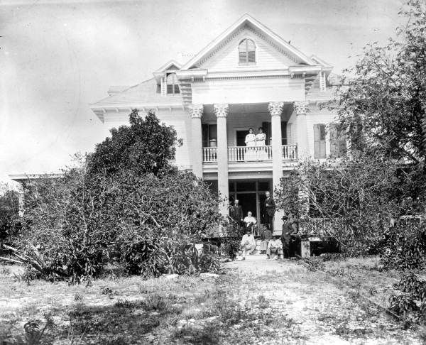
· Brickell Mansion (demolished) (includes photograph of house)
Erected by Miami Parks & Recreation.
Topics. This historical marker is listed in these topic lists: Anthropology & Archaeology • Cemeteries & Burial Sites • Industry & Commerce • Native Americans. A significant historical year for this entry is 1921.
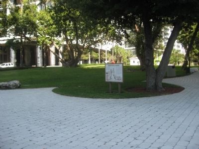
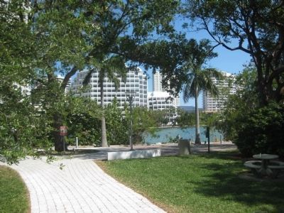
Location. 25° 46.087′ N, 80° 11.396′ W. Marker is in Miami, Florida, in Miami-Dade County. Marker is on Brickell Avenue (U.S. 1/41) south of Southeast 5th Street, on the right when traveling north. The park is located in Miami's urban Brickell neighborhood about 500 feet south of the Miami River. From Brickell Avenue it stretches east to Biscayne Bay, where it looks across to Brickell Key. The park is one block east of the Metromover's Brickell loop, which is accessible via 5th Street Station. Touch for map. Marker is at or near this postal address: 501 Brickell Avenue, Miami FL 33131, United States of America. Touch for directions.
Other nearby markers. At least 8 other markers are within walking distance of this marker. Mary Brickell Park (here, next to this marker); The People of Brickell Point (about 500 feet away, measured in a direct line); The Miami Circle at Brickell Point (about 500 feet away); The Miami Circle (about 600 feet away); Saving the Circle (about 700 feet away); Office of Dr. James Jackson, Miami's First Physician (approx. half a mile away); Dade County (approx. half a mile away); Menendez on Biscayne Bay (approx. 0.6 miles away). Touch for a list and map of all markers in Miami.
More about this marker. The marker stands at the park entrance off Brickell Avenue. On the marker appears the logo of Miami Parks & Recreation.
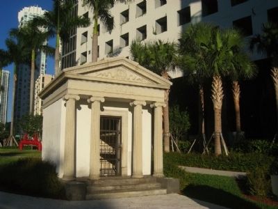
Regarding Brickell Park. The empty Brickell Mausoleum was added to the National Register of Historic Places in 1989 (reference #88002977). The Classical revival-style, granite structure features four ionic columns and Brickell name emblazoned across the frieze.
The site where the Brickell mansion stood is just north of the park, where now stands a high-rise residential complex. A river walk along the park's east side follows a path around the high-rise to the north end of Brickell Point, where it connects with the Miami Circle Park.
Related markers. Click here for a list of markers that are related to this marker. These markers explain the history of the Miami Circle and Brickell Point.
Credits. This page was last revised on June 16, 2016. It was originally submitted on March 29, 2013, by Glenn Sheffield of Tampa, Florida. This page has been viewed 1,034 times since then and 64 times this year. Last updated on May 31, 2013, by Glenn Sheffield of Tampa, Florida. Photos: 1. submitted on March 29, 2013, by Glenn Sheffield of Tampa, Florida. 2, 3, 4, 5, 6, 7. submitted on March 30, 2013, by Glenn Sheffield of Tampa, Florida. • Bill Pfingsten was the editor who published this page.
