Fort Story in Virginia Beach, Virginia — The American South (Mid-Atlantic)
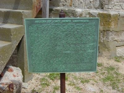
History of Cape Henry Lighthouse
Governor Alexander Spotswood first proposed building a lighthouse at Cape Henry in a message to the Virginia House of Burgesses on November 27, 1720. He suggested the province of Maryland should help pay part of the construction costs. For the next thirty-two years, various sessions of the House of Burgesses proposed building a lighthouse at Cape Henry with assistance from Maryland, but nothing was done. Finally, in 1752, the General Assembly passed an act to construct the lighthouse using revenues on an export tax on tobacco to pay for it. In 1759, the British Government disallowed the law, claiming the tax would infringe on the tobacco trade. In 1772, another act was passed and 6,000 pounds were appropriated for building the lighthouse. Construction began before the British could object but the American Revolution stopped further progress. During the war, a lookout station and signal fires were maintained to warn of the approach of enemy ships.
In 1789, the first congress of the United States at their first session enacted a law to establish a lighthouse on Cape Henry near the entrance to Chesapeake Bay. President George Washington approved the law on August 7, 1789. The lighthouse was the first federal building authorized by the United States Government under the Constitution.
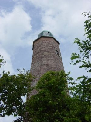
Two acres of land on Cape Henry were ceded by the State of Virginia to the federal government and a contract was concluded to erect and equip the lighthouse. The contractor had serious problems transporting the sandstone used in the construction of the ninety foot tower. However, the stone has a special significance since it came from the same Aquia, Virginia quarries that provided stone or Mount Vernon, the U.S. Capitol, and the White House. In 1791, the lighthouse was completed at a cost of $17,500. Whale oil (later kerosene) was burned for illumination, first in an "iron lanthorn", then in Argand lamps with metal reflectors.
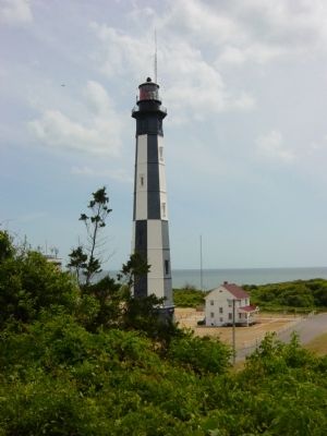
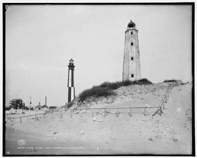
In 1861, the light was damaged by Civil War fighting. The first lightship was put into service between Cape Henry and Cape Charles in 1861. It continued until 1863, when the lighthouse was repaired and service was restored. The light continued to shine until 1881 when it was replaced by the modern lighthouse nearby which is still in use today.
Topics and series. This historical marker is listed in these topic lists: Communications • War, US Civil • War, US Revolutionary • Waterways & Vessels. In addition, it is included in the Former U.S. Presidents: #01 George Washington, the Lighthouses, and the National Historic Landmarks series lists. A significant historical date for this entry is November 27, 1720.
Location. 36° 55.54′ N, 76°
Photographed By Mike Wintermantel, June 2, 2007
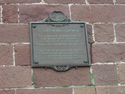
2. Old Cape Henry Lighthouse Marker
First lighthouse authorized by the first United State Congress. Erected in 1791, it lighted the entrance into Chesapeake Bay until 1881.
Owned by the Association for the Preservation of Virginia Antiquities. As deeded in 1930 by the Congress of the United States.
Owned by the Association for the Preservation of Virginia Antiquities. As deeded in 1930 by the Congress of the United States.
Other nearby markers. At least 8 other markers are within walking distance of this marker. First Public Works Project of the United States Government (a few steps from this marker); First Landing (a few steps from this marker); Old Cape Henry Lighthouse (within shouting distance of this marker); British Naval Blockade and Cape Henry Lighthouse / The War of 1812 (within shouting distance of this marker); Fort Story (within shouting distance of this marker); Cape Henry Railroads (about 300 feet away, measured in a direct line); Battle of the Capes 1781 (approx. 0.2 miles away); Cape Henry Memorial (approx. 0.2 miles away). Touch for a list and map of all markers in Virginia Beach.
Also see . . .
1. Cape Henry Lighthouse. Preservation Virginia entry (Submitted on June 3, 2013, by Mike Wintermantel of Pittsburgh, Pennsylvania.)
2. Cape Henry Lighthouse. Wikipedia entry (Submitted on March 14, 2021, by Larry Gertner of New York, New York.)
Photographed By Mike Wintermantel, June 2, 2007
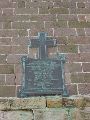
5. Near This Spot
Captain Gabriel Archer Christopher Newport
Hon. George S. Percy Bartholomew Gobfold
Edward Maria Vincefeld
With twenty-five others
Who
Calling the place
"Cape Henry"
Planted a cross
April 29, 1607
"Dei Gratia Virginia Condita"
This tablet is erected by the Association for Preservation of Virginia Antiquities
April 29, 1896
Click for more information.
Credits. This page was last revised on February 1, 2023. It was originally submitted on June 3, 2013, by Mike Wintermantel of Pittsburgh, Pennsylvania. This page has been viewed 1,105 times since then and 54 times this year. Photos: 1, 2, 3, 4, 5. submitted on June 3, 2013, by Mike Wintermantel of Pittsburgh, Pennsylvania. 6. submitted on June 3, 2013.
