Stuart in Patrick County, Virginia — The American South (Mid-Atlantic)
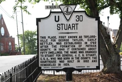
Stuart
Erected 1941 by Virginia Conversation Commission. (Marker Number U-30.)
Topics and series. This historical marker is listed in this topic list: Political Subdivisions. In addition, it is included in the Virginia Department of Historic Resources (DHR) series list. A significant historical year for this entry is 1792.
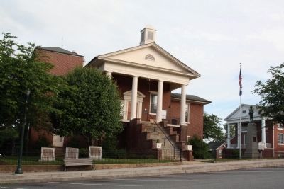
Location. 36° 38.54′ N, 80° 16.172′ W. Marker is in Stuart, Virginia, in Patrick County. Marker is at the intersection of West Blue Ridge Street (Virginia Route 8) and North Main Street, on the left when traveling west on West Blue Ridge Street. It is at the courthouse. Touch for map. Marker is in this post office area: Stuart VA 24171, United States of America. Touch for directions.
Other nearby markers. At least 8 other markers are within 11 miles of this marker, measured as the crow flies. Blue Ridge Mission School (approx. 6.6 miles away); The Reynolds Homestead (approx. 6.7 miles away); a different marker also named Reynolds Homestead (approx. 6.9 miles away); William Byrd’s Survey of 1728 (approx. 6.9 miles away); Jacks Creek Covered Bridge (approx. 8.4 miles away); Meadows of Dan (approx. 10.1 miles away); Colonel Abram Penn (approx. 10.3 miles away); Rural Life In Appalachia (approx. 10.6 miles away).
Regarding Stuart. Stuart was the western terminus of the Danville and Western Railway. A 1925 timetable shows two daily trains in each direction connecting Stuart with the Southern Railway’s main line in Danville 75 rail miles away. In Danville, fast trains north to Washington, New York and Boston, and south to Atlanta and New Orleans ran frequently. But the trains between Stuart and Danville were never fast—the 1925 timetable quotes a five hour ride—and the railway was nicknamed the “delay and wait” and the “dick and willie.” The tracks to Stuart were abandoned in 1942.
Also see . . . Wikipedia Entry. “Following the economic difficulties of the civil war, the residents of Taylorsville focused their energies on expanding railroads to boost the economy. The Danville and New River Railroad was chartered in 1873. ... The first train pulled into
Taylorsville in August 1884. With the growth associated with the railroad, Taylorsville was incorporated as a town in 1884 and was renamed Stuart in honor of Confederate Major General J.E.B. Stuart, who was born 20 miles southwest of town in Ararat, Virginia.
“Following the completion of the railroad, the town of Stuart continued to grow steadily. The population increased 25% from 300 in 1884 to 371 in 1900. While occupations continued to center around the courthouse activities and the typical needs of a community, the 1900 census reflects the influence of the railroad by citing four railroad employees, eight salesmen, one insurance agent, one mining engineer, and one timber dealer. Five teachers, three hotels, two druggists, and two bartenders also indicate the growth of the town. The construction of the railroad led to the distinction of ‘uptown’ and ‘downtown’ Stuart, since the original courthouse village was situated at the crest of a hill and an industrial and commercial area developed adjacent to the railroad, which was located further downhill along the Mayo River. ‘Uptown’ continued to serve as the center of the town with the courthouse, churches, school, attorneys’ offices, banks, hotels, and stores. The two areas, however, were closely related and interdependent as is evidenced by the town’s first telephone line at the turn of the twentieth century being
run between the railroad depot downtown and the Hotel Perkins uptown.” (Submitted on June 9, 2013.)
Credits. This page was last revised on June 16, 2016. It was originally submitted on June 9, 2013, by J. J. Prats of Powell, Ohio. This page has been viewed 567 times since then and 30 times this year. Photos: 1, 2, 3. submitted on June 9, 2013, by J. J. Prats of Powell, Ohio.
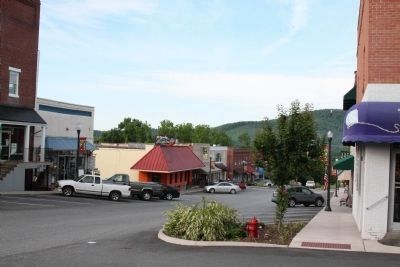
Editor’s want-list for this marker. Photo of downtown business district • Can you help?


